Bariloche has a lot to offer for a relaxing vacation and makes it a popular destination for travellers in the region.
San Carlos de Bariloche is about a two hours flight north of El Calafate. Having lived in the Northern Atmosphere for my whole life, we believe going north means going to cooler weather, only to discover it works the other way in the Southern Atmosphere. We were met with warmer weather in San Carlos de Bariloche. We rented a car for the first time in Argentina with the places we plan to visit being more spread out. The car rental experience cannot be more different from the rental experience in the States. It took us over an hour, mostly waiting with only us in the line, to get the rental. When we finally got to the parking lot, the Avis rental lady took a lot of pictures of an unassuming Fiat. She carefully showed us the repair kit and spare tire, reminded us of the speed limit and the police camera before emailing the rental contract with all the pictures she had taken. It turned out the extra caution is not a sign of danger, more that the city has narrow roads, and is not always paved.
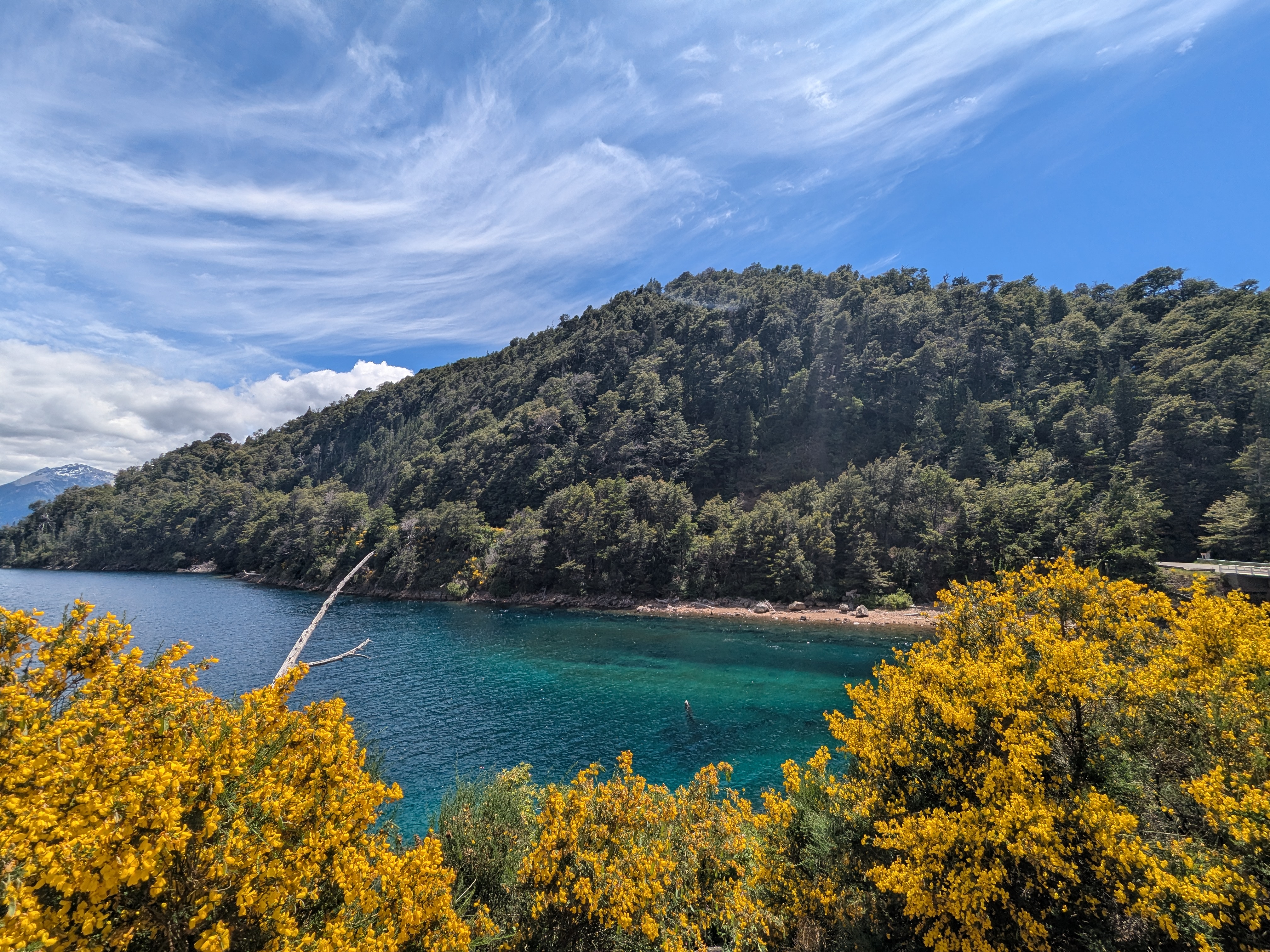
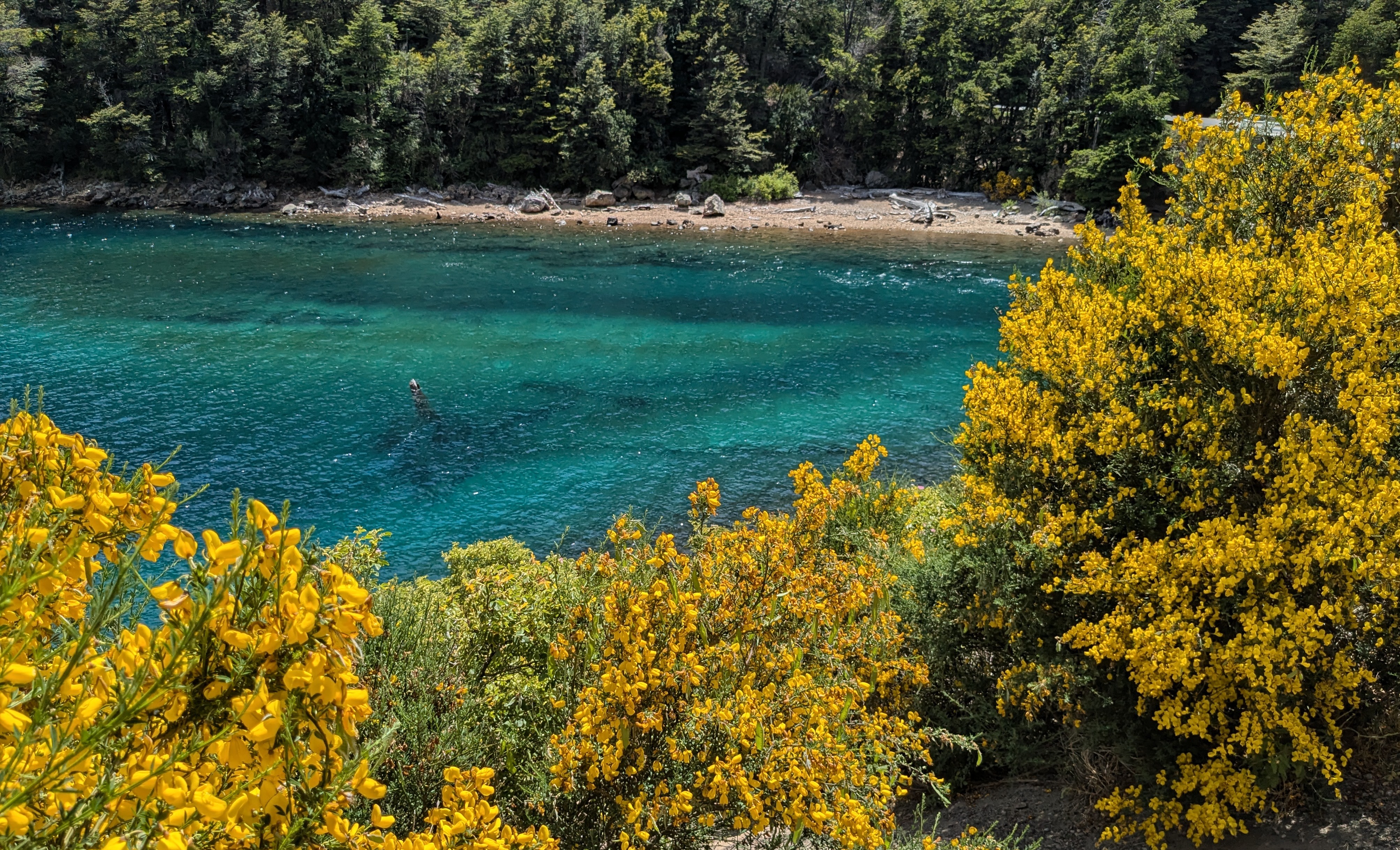
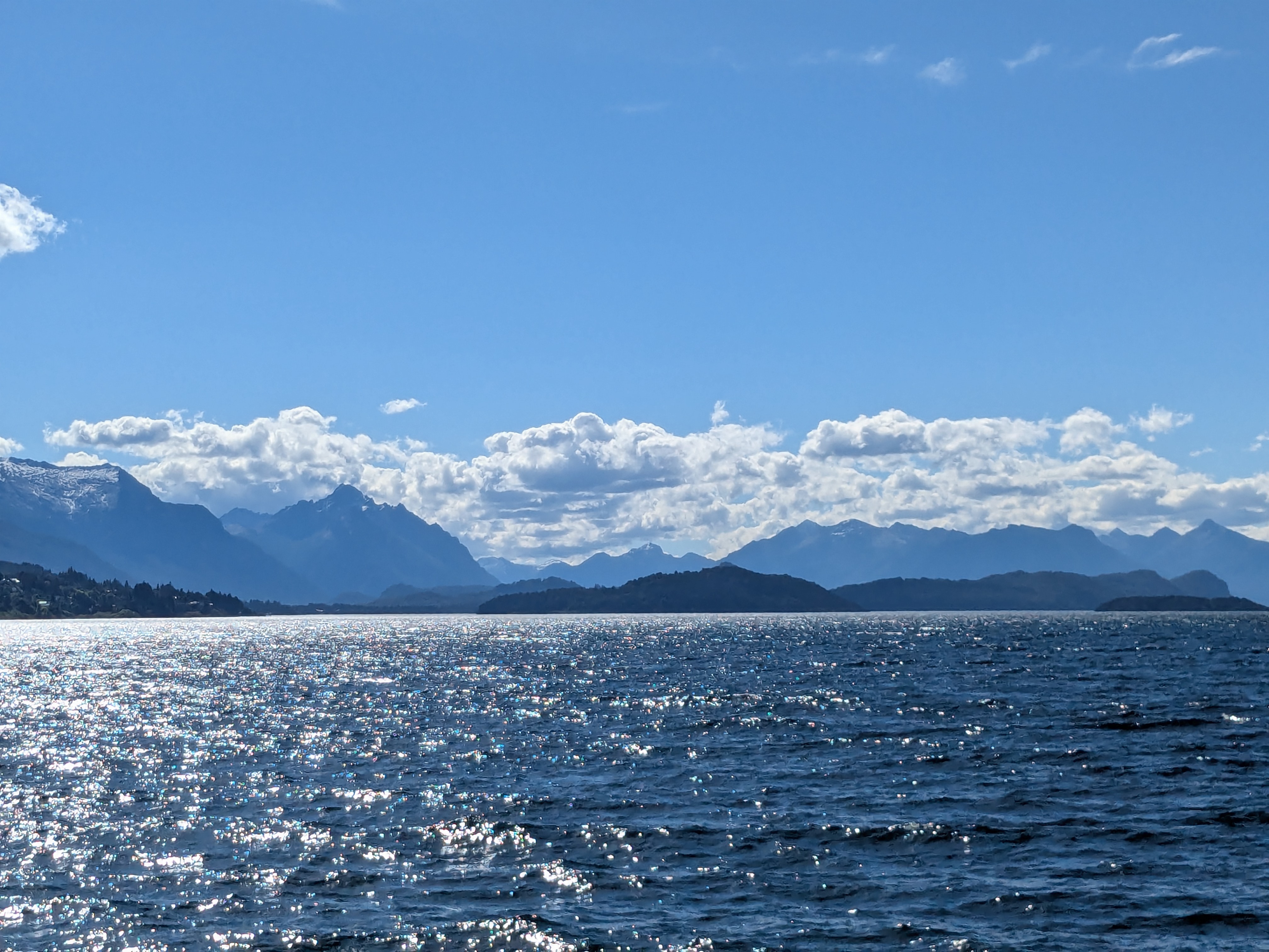
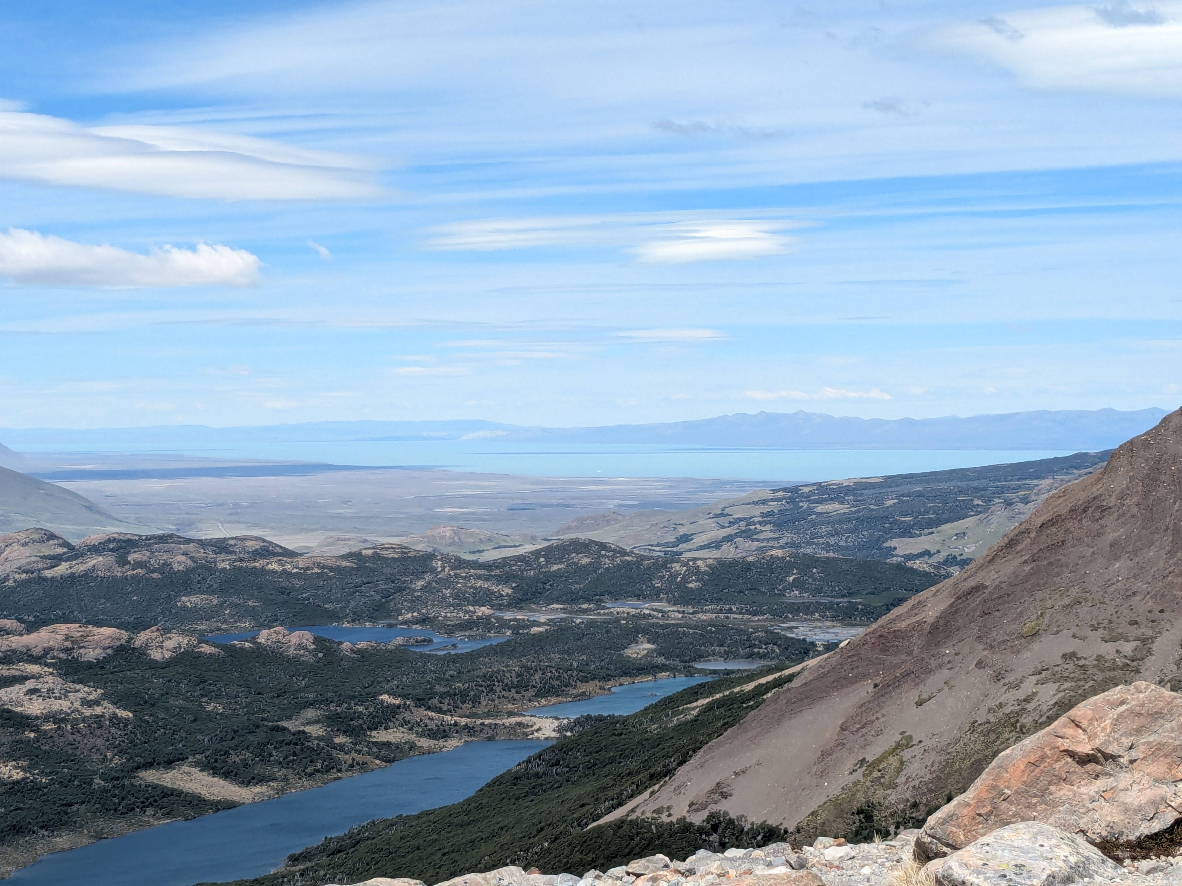
We safely arrived at our Airbnb which is on a narrow street. Fortunately, our Airbnb host Mariano met us outside and there was a very small parking garage. Airbnb reminded us of the beautiful Airbnb we had in Buenos Aires. It is a 2-story unit on the 7th floor with a great view of Nahuel Huapi Lake. Nahuei Huapi Lake is a massive, crystal-clear glacial lake in Argentina’s Patagonia region. The Chilean Border is only about an hour and a half drive.
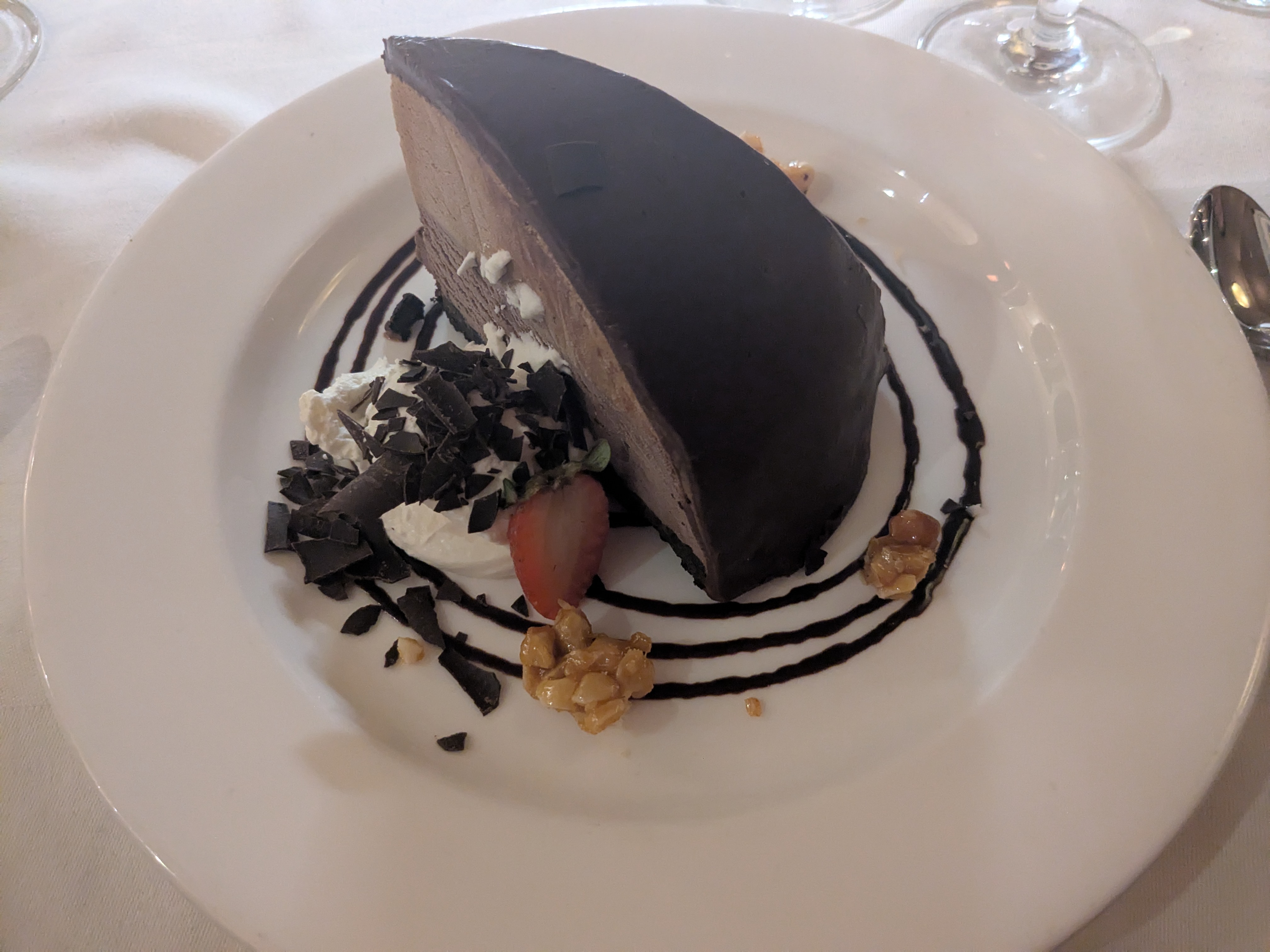
San Carlos de Bariloche downtown has a street lined up with many chocolate stores. Even though the chocolate is not as world renowned as Swiss Chocolate, the quality is equally good, and we recommended “Nanpui” for their chocolates. Almost all the chocolates sold have warning signs of “too much sugar” and “too much fat” on the box. These signs do not deter any customers. From the chocolate street, it was an easy stroll to the lake front. There were some antique cars events on the day, and the city center was crowded with spectators. After a month in Argentina, we craved Chinese food and had an early dinner at Wong, one of the only two Chinese restaurants in town.
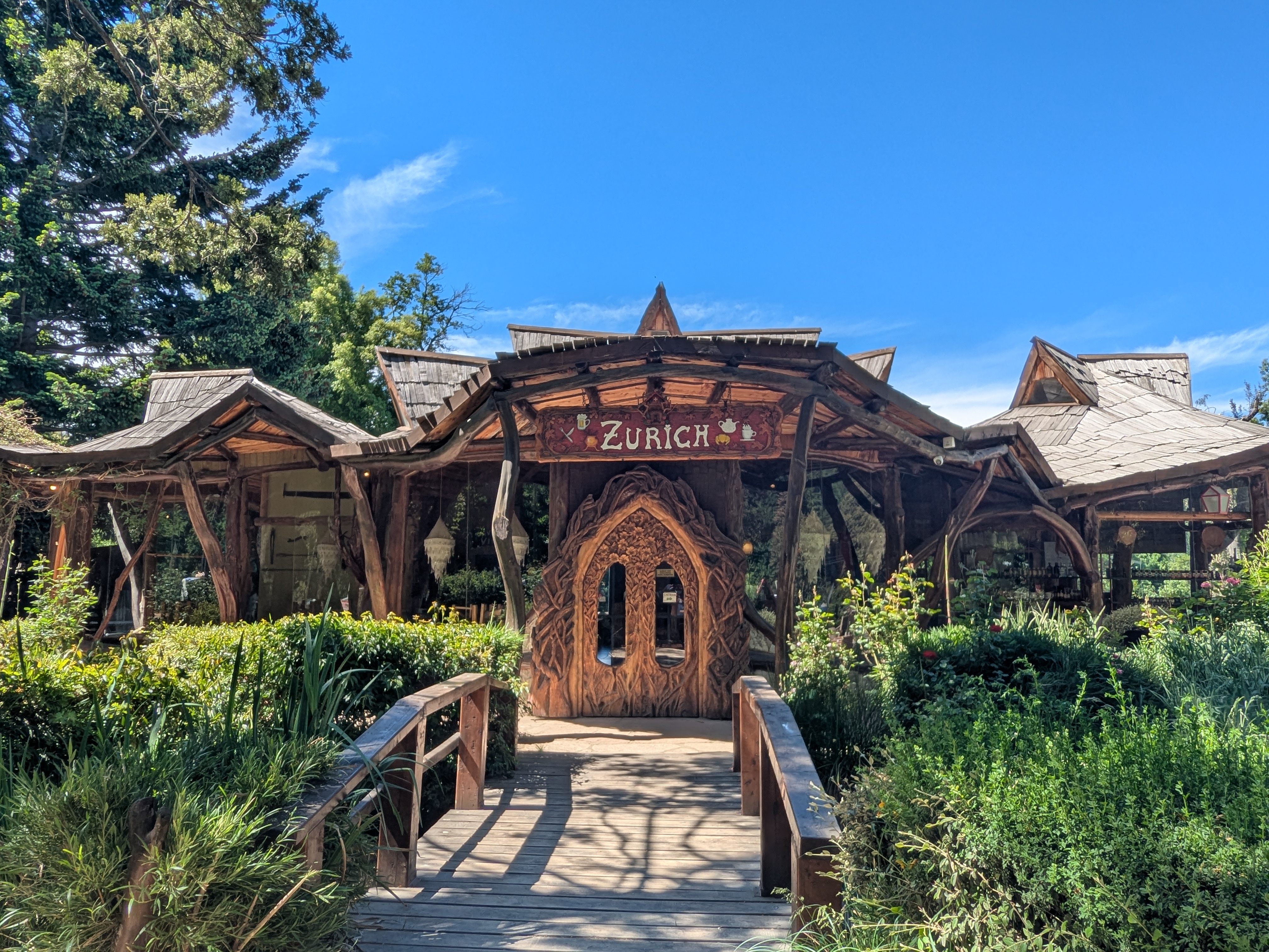
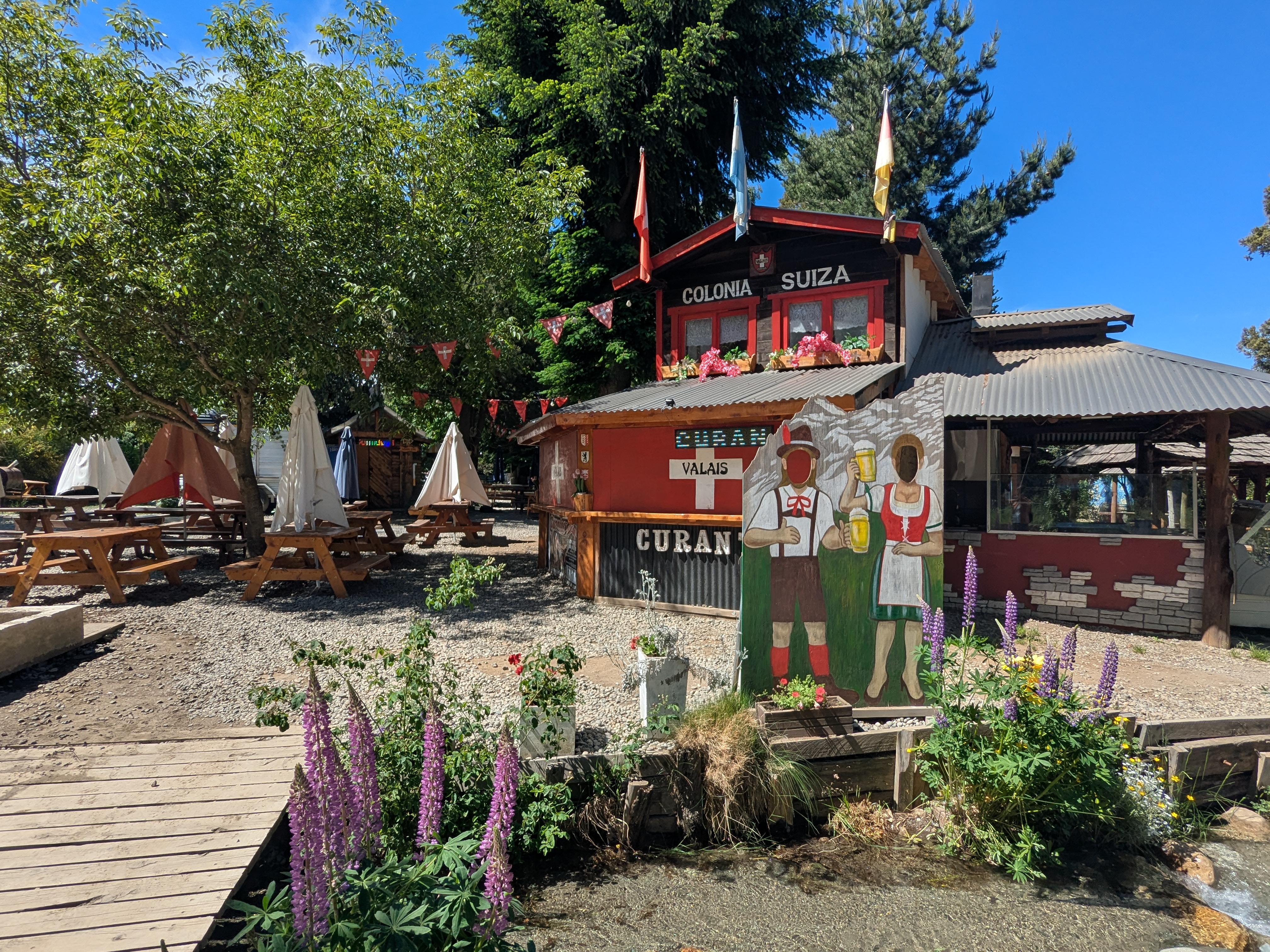
If you only have a day, the Circuito Chico is a convenient one-day road trip. There are chairlifts and hiking trails to walk up to enjoy some gorgeous views of lakes and mountains. The Llao Llao hotel is a top 5 star hotel with rustic cottage decor and a good place to enjoy snacks. Its service does not live up to the 5 star standard. The Colonial Suiza, a small Swiss-style town, can only be reached through gravel roads. We drove so very slowly that the rental Fiat handled the gravels without causing a flat tire. There were small ships good for getting some souvenirs, and we got some Patagonian tea bags. In Patagonia, the animals do not seem to be scared of people. We saw a small fox stopping in the middle of the road and did not seem to care.
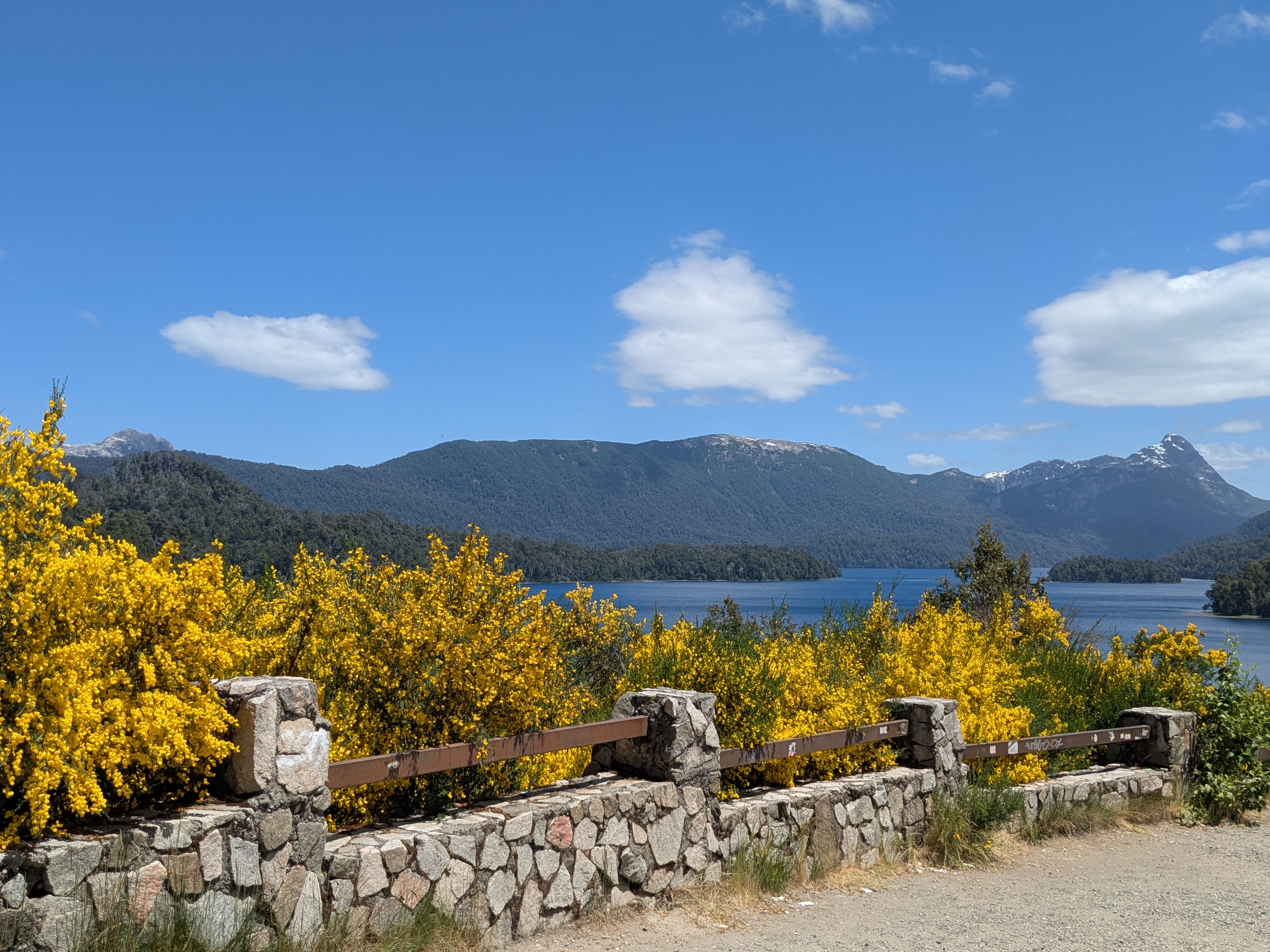
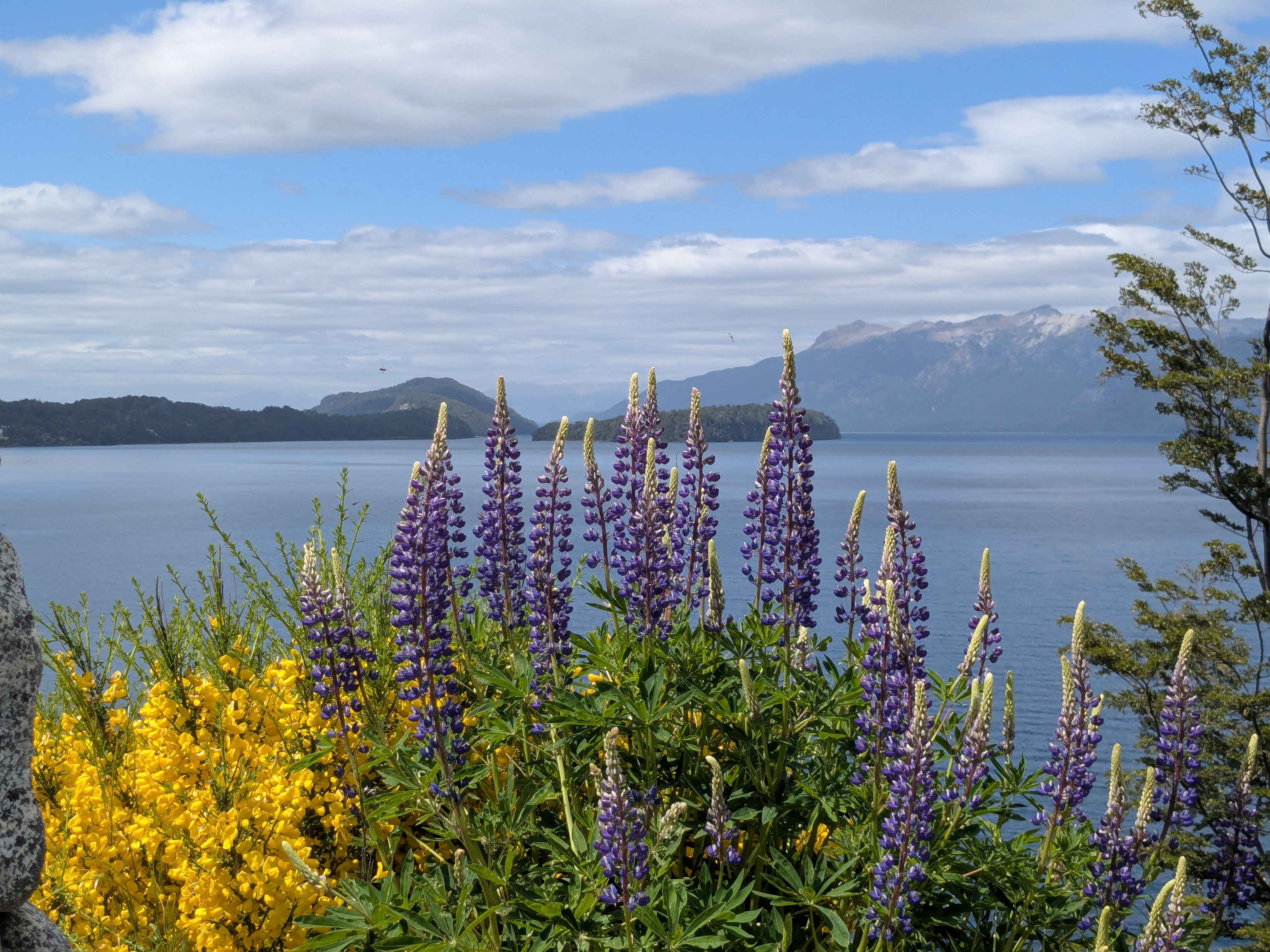
If you have more than one day, the seven lakes road trip would take you to Nahuei Huapi and Lanin National Park. It makes a full day trip on a scenic 110-120 km stretch of the famous National Route 40. There are lakes after lakes, small and large. Living up to the Patagonia wilderness, there are only two big towns: Villa de Angostura and San Martin de Andes; there are hardly any other small towns or inhabitants in between. Angostura is a charming small town with shops and eateries, and better roads. These lakes remind me of Lake Tahoe, equally beautiful. The seven lakes are enhanced with the surrounding forestry landscape and at times the beautiful bright yellow Scotch Broom and purple Lupines lining up along the freeway. It is an easier road trip with the well paved National Route 40 that connects the national parks of Argentina in Patagonia.
If you have more than two days, there is a boat trip to Victoria Island and Forest of Arran where Sequoia Trees, Black Sand Beach, Native Trees and Hiking trails await.
Bariloche is Patagonia with peaceful lakes, Swiss atmosphere, chocolates and National Parks connected through a myriad of roads, from unpaved to well paved, with speed limit from 20, 40, 60 and 80 km per hour.
Few travellers spend five weeks in Argentina on their first trip to South America. We had experiences for a life time.
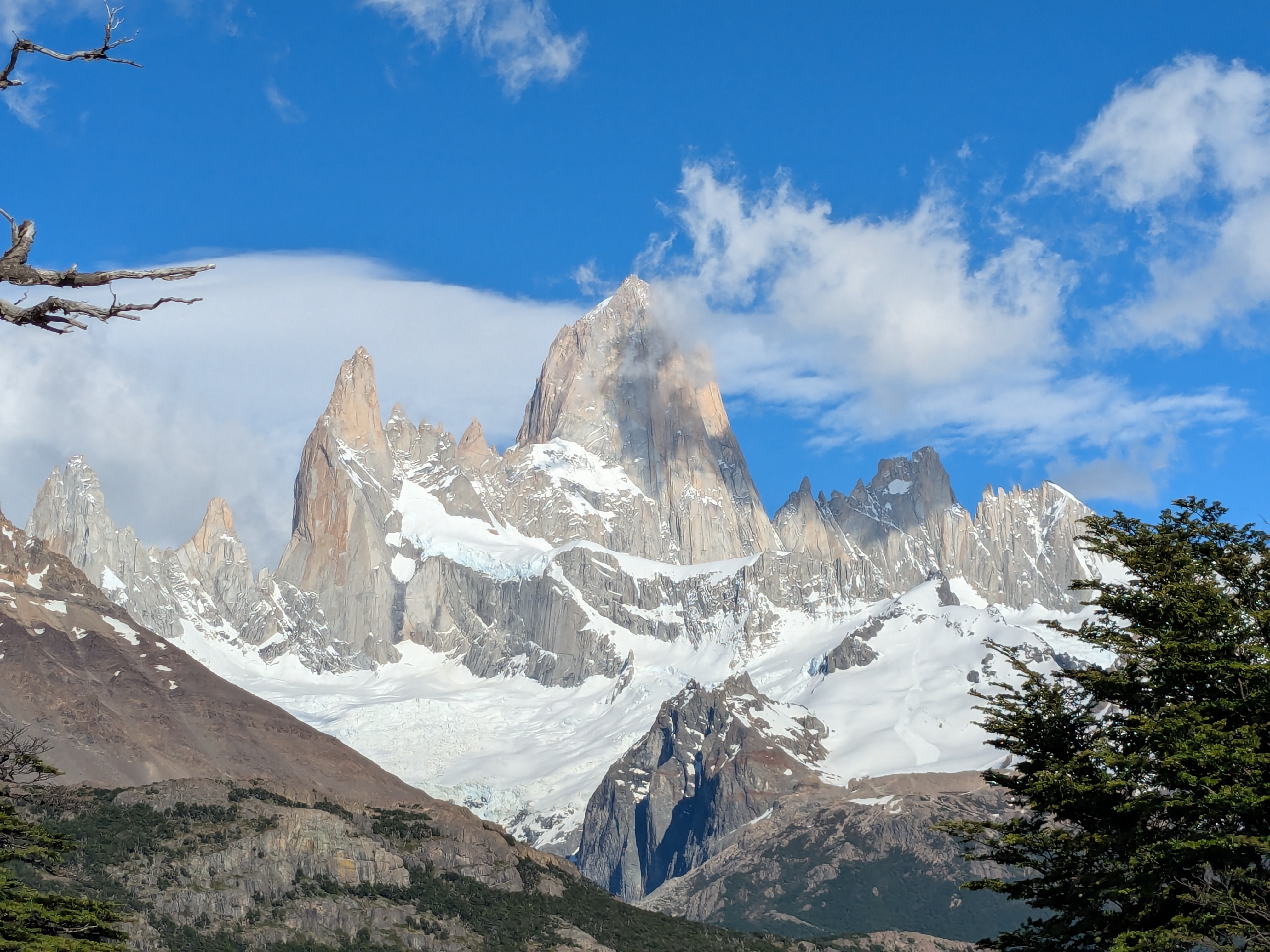
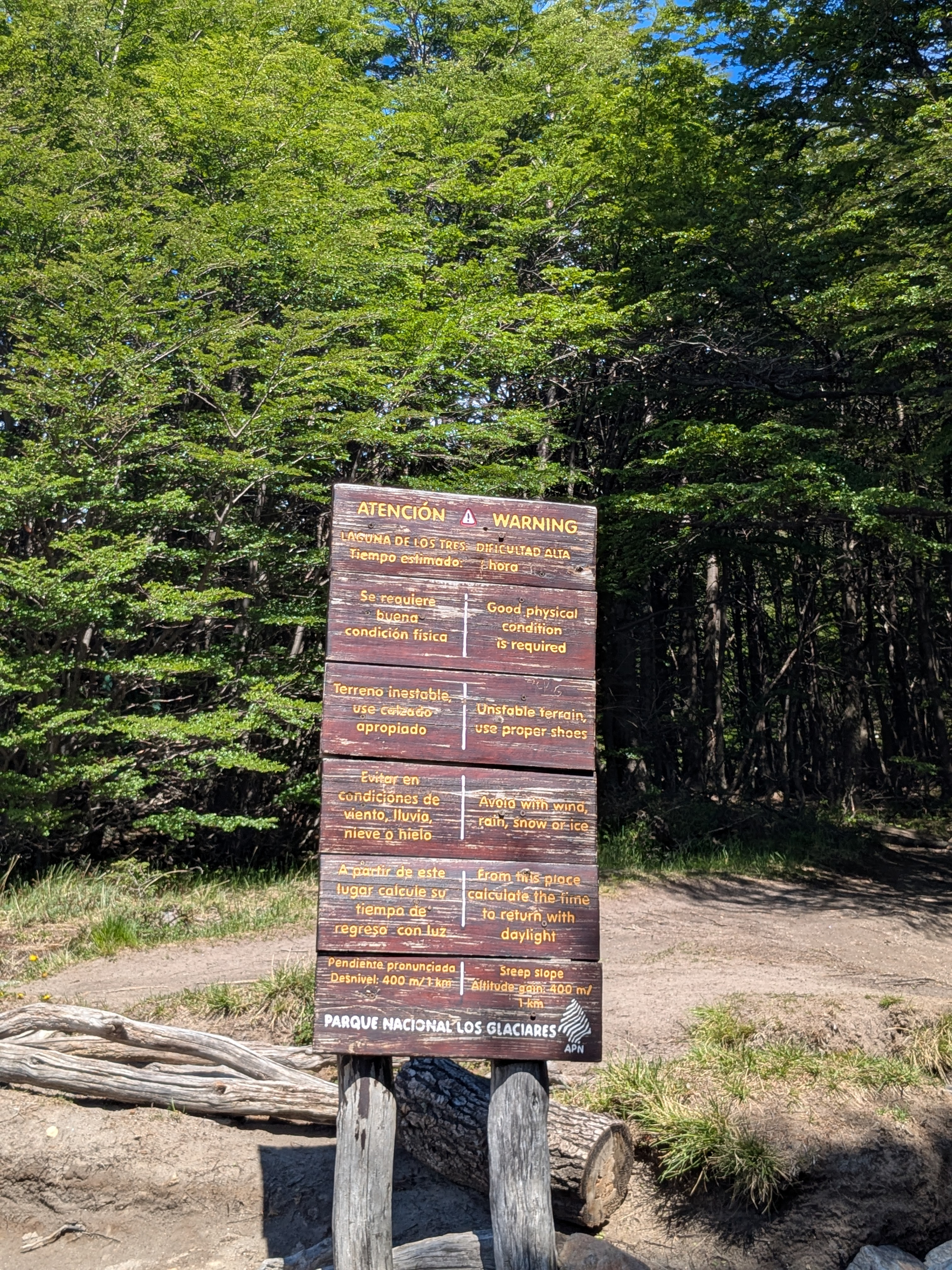
The ultimate hike Laguna de Los Tres is a 20km (10km one way) full day hike, and many consider the last 1km as very very very tough. I have a bit of acrophobia, and receive reassurance that the hike is not next to a cliff or any of the dangerous treks, but have little idea how tough the trail is. We are slow hikers so we started early at 7am in the morning, with some bottles of water, raingears, and a pole.
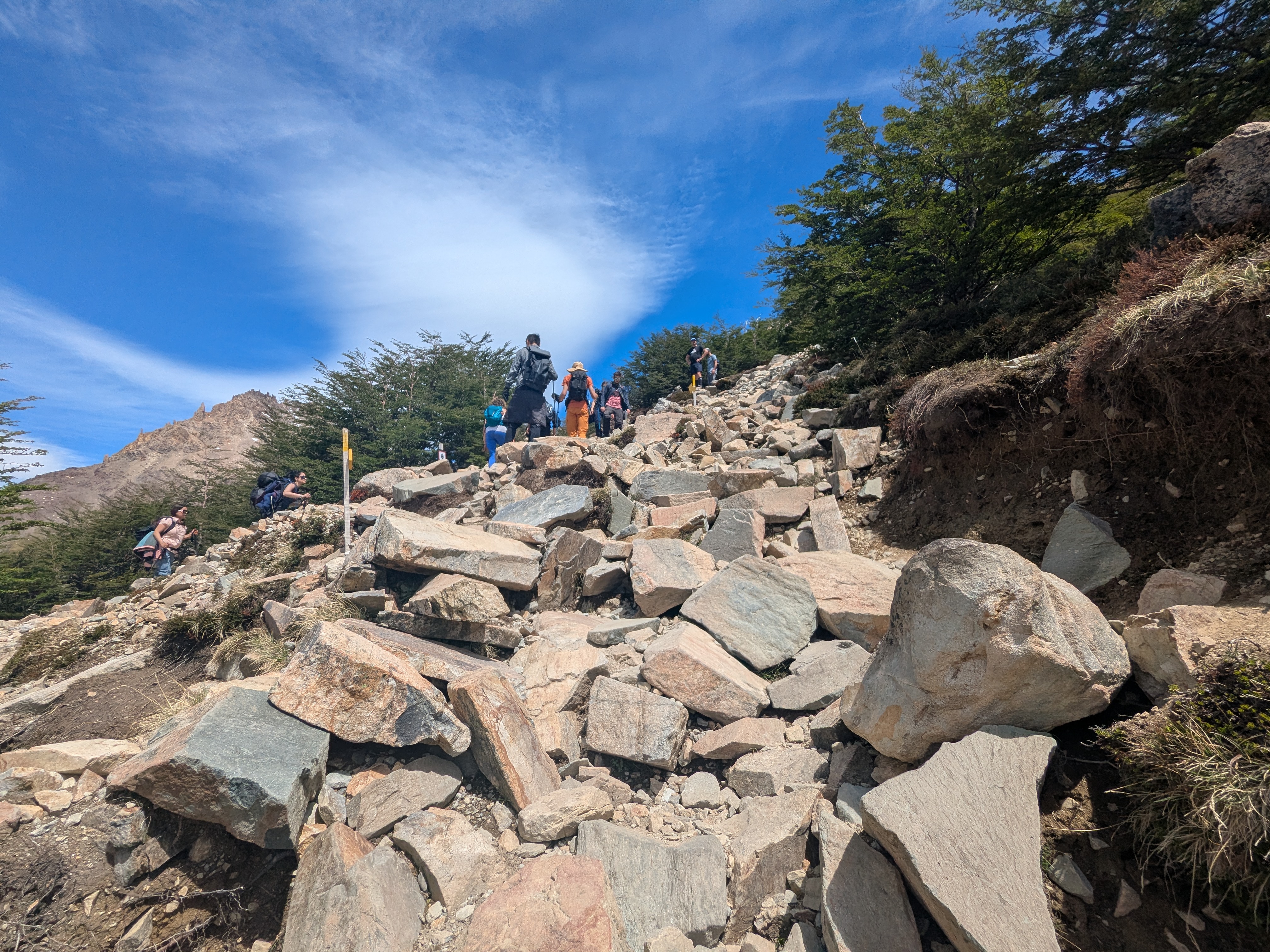
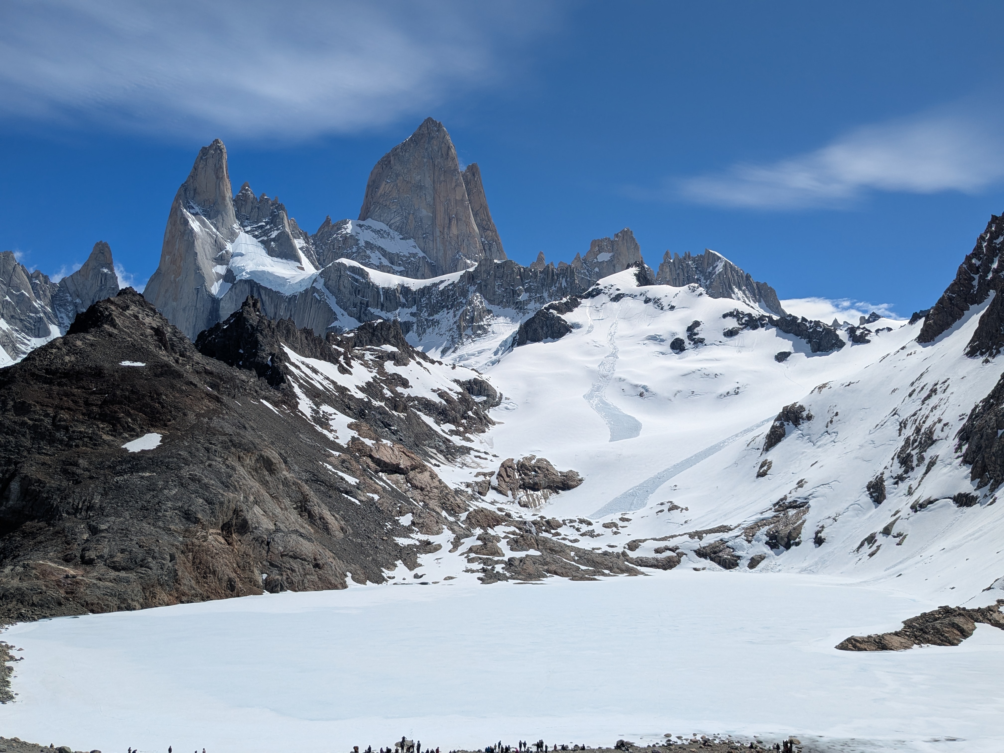
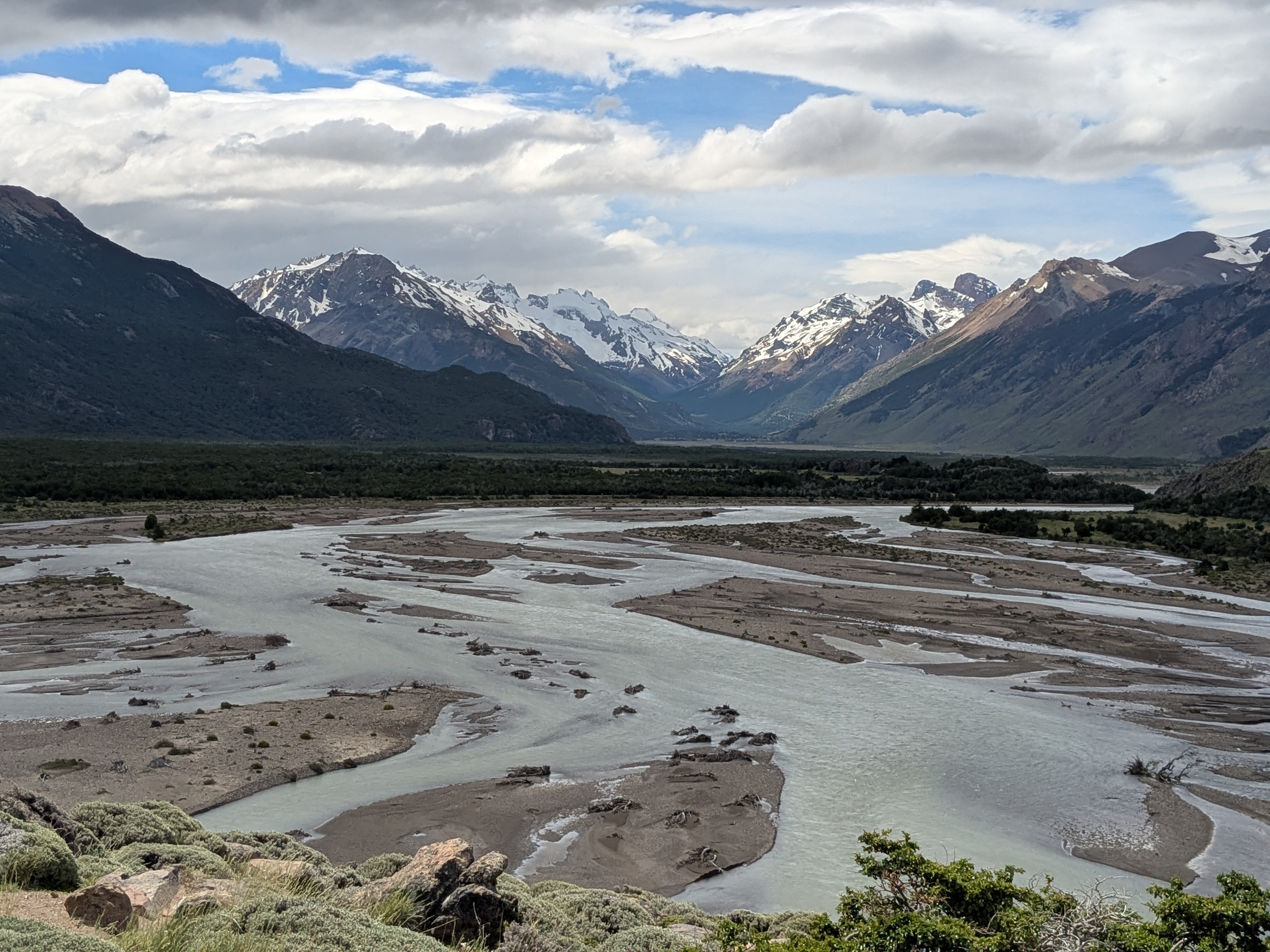
Along the trail, there are signs for each kilometer. In the first few kilometers, we took the time to enjoy nature, admire Mount Fitz Roy from afar, take pictures, let other hikers pass by, while carefully avoiding patches of muddy terrains to keep our shoes dry. Along the way, we ran into Jackie, the solo British traveller we met at the Nibepo Aike Estancia, the second time in two days. After a few hours, we got to the 9km mark feeling pretty good. There is a warning that the next 1km requires top fitness level. The last 1km uphill has taken us over 2 hours over very tough terrains, and hiking down was equally not not tougher. Laguna de Los Tres certainly lives up to its reputation.
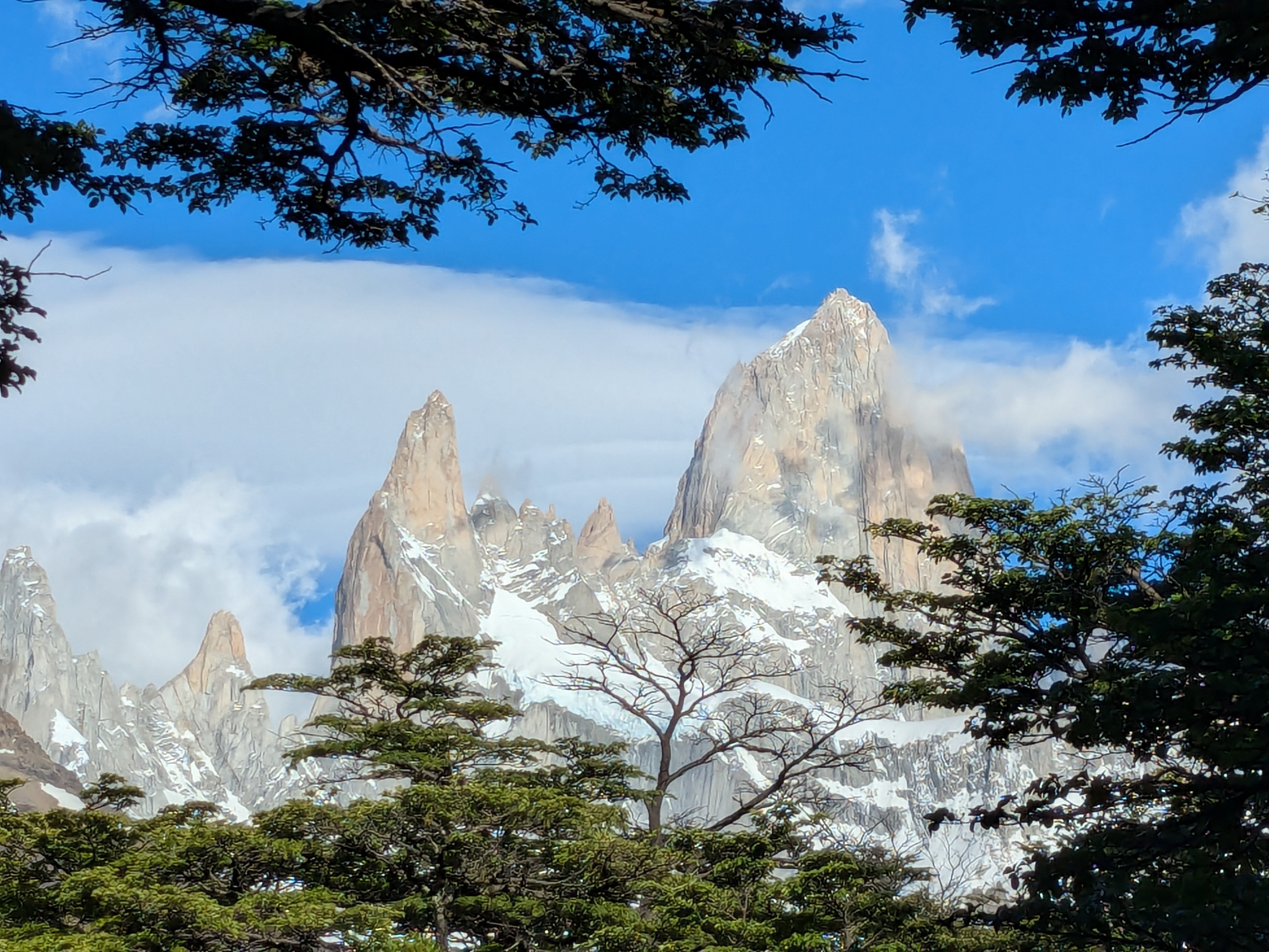
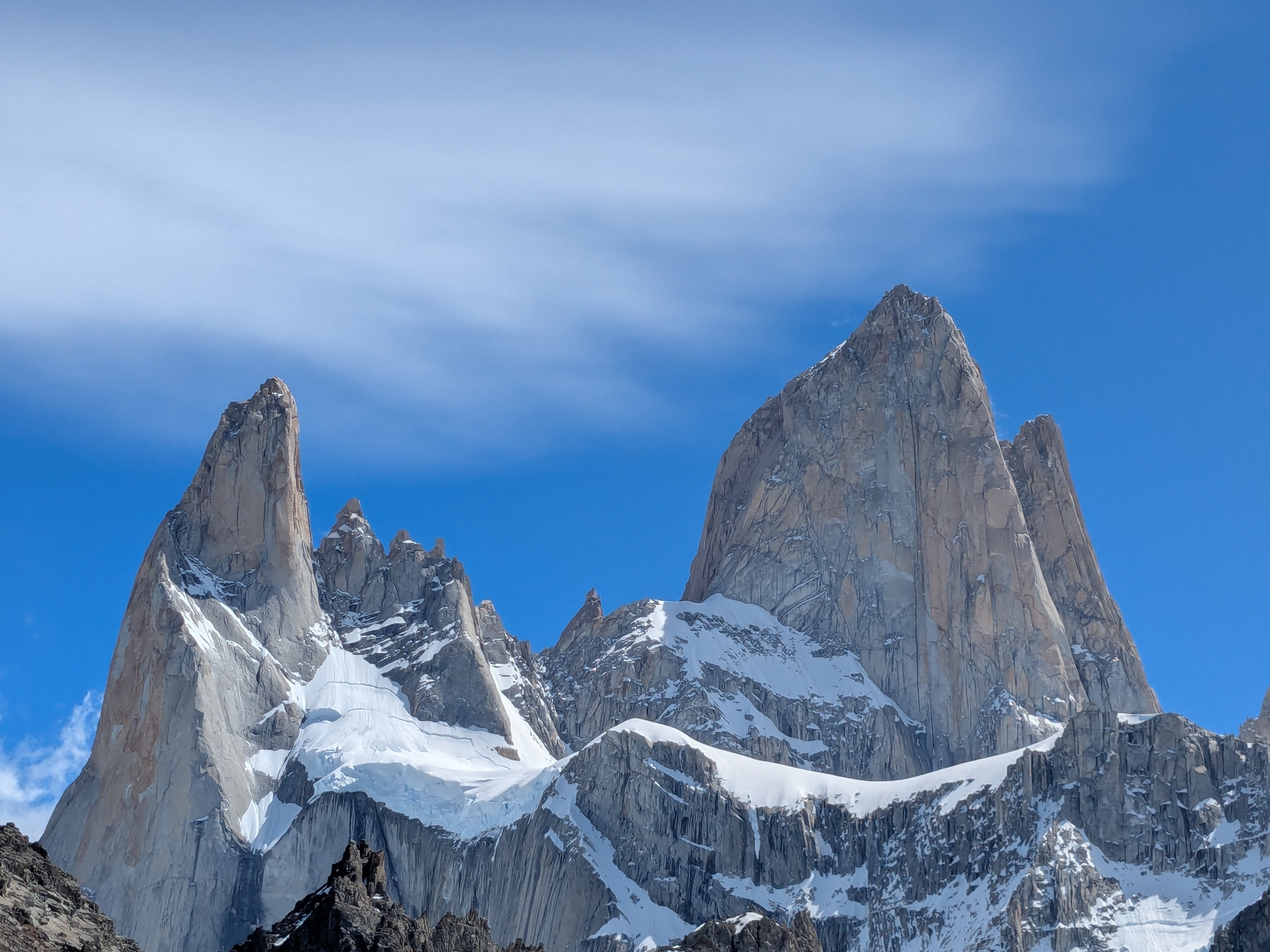
It was still Spring time, the main Laguna de los Tres, directly below Mount Fitz Roy, was not yet defrosted. The frozen lake was connected seamlessly with the snow on the mountain. It was super beautiful and the air was refreshing. The frozen lake has not shown its turquoise charm we often find in pictures. We were rewarded with the snow-capped Fitz Roy peaks in a comfortable chilly weather, with a lone fox wandering among us, hikers. We took the views all in at the summit. Fitz Roy towers above us, on the other side, we saw the beautiful larger blue Laguna (Laguna Sucia/Laguna Capri/Lago Argentina).
We could have stayed here for much longer, but it was time to head back. With our slow pace, it was getting dark. The hike started at 7am and we returned by 9pm. This is arguably the longest hike we had done since the Half Dome at Yosemite decades ago. This one feels tougher. At the end, we could feel that we lost some belly fat and some weight. It was such an experience that it felt like if this Laguna De Los Tres became our very last tough hike, it would be all right. Do we still have more in our tank for future hikes of similar challenges? Only time will tell.
The next day, we chilled at a nearby meme cake cafe, enjoyed an excellent chocolate mint tea, served in an iron pot. Thigh and hip muscle fatigue aside, our joints felt good. Thanks to Taichi practice in the last few months. After a day of rest, we felt ready for some easy short hike.
The day after, we started the day with a Cappuccino and Mocha at the Macchiato cafe right across the street. Talked to the barista about their sold out beautifully designed t-shirt that reminds us of the T-shirt displayed in a similar coffee shop in one of our Hawaii trips.
Some hikes stay with you forever — Laguna de los Tres is one of ours.
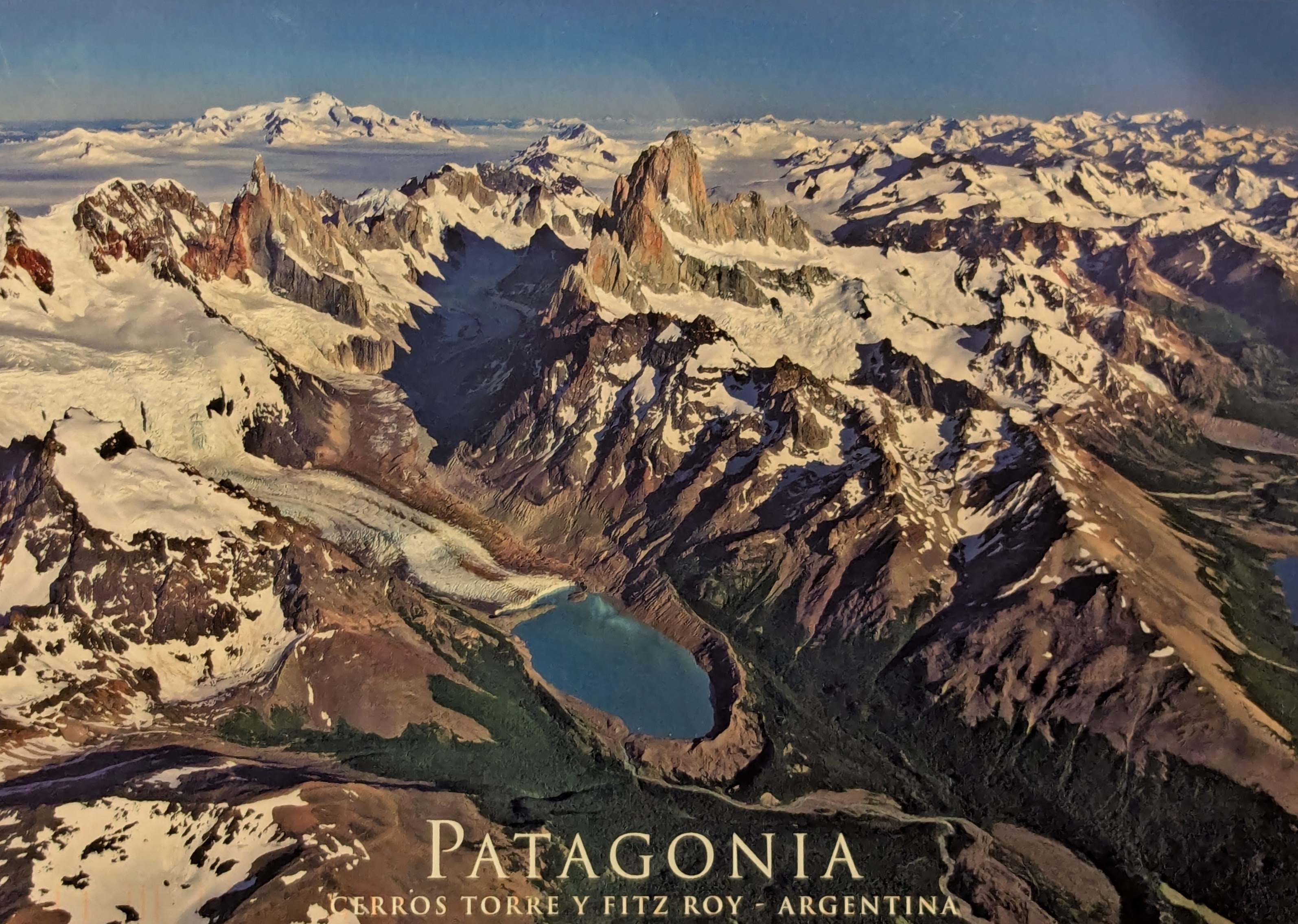
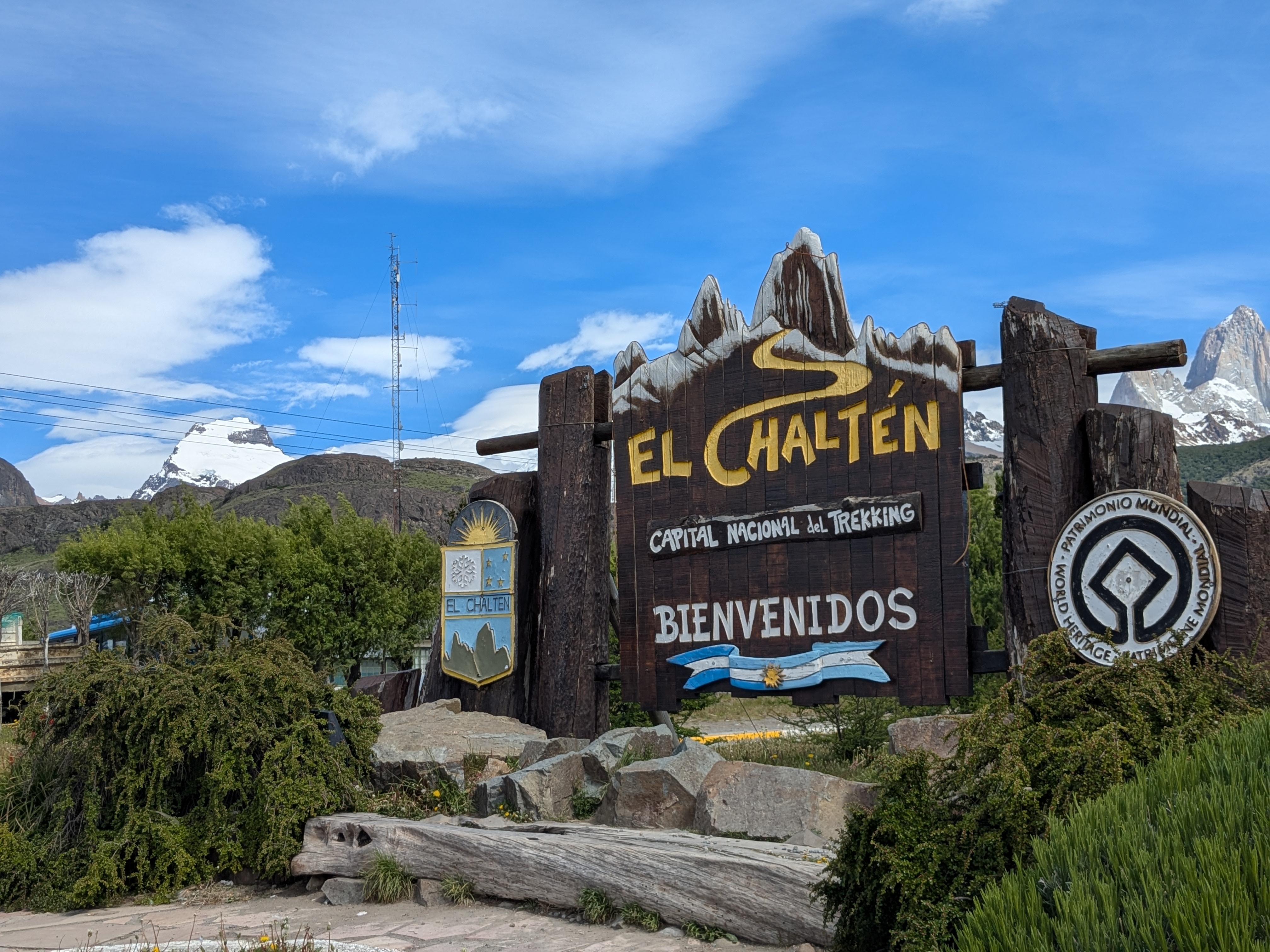
El Chaltén is the hikers paradise. It is the place where hikers meet and it has the iconic hike of Lagoon de Los Tres. Laguna de los Tres offers breathtaking, close-up views of Mount Fitz Roy and its glacier. The 20 km round trip takes 7–9 hours. Laguna de los Tres, “Lake of the Three”, is not about three lakes, It refers to the three prominent peaks towering above the lake, which are Mount Fitz Roy, Poincenot, and Saint-Exupéry, located in Los Glaciares National Park near El Chalten, Argentina. Fitz Roy captained the HMS Beagle Charles Darwin was on almost two hundred years ago. He explored the El Chaltén region with Charles Darwin in 1834.
We are not among the rock climbers who scale the Granite Wall of Mount Fitz Roy. Chouinard and team did that back in 1968 (Pg 45 to 52 of Dirtbag Billionaire) before he founded the Patagonia company. The Patagonia logo is based on none other than Mount Fitz Roy.
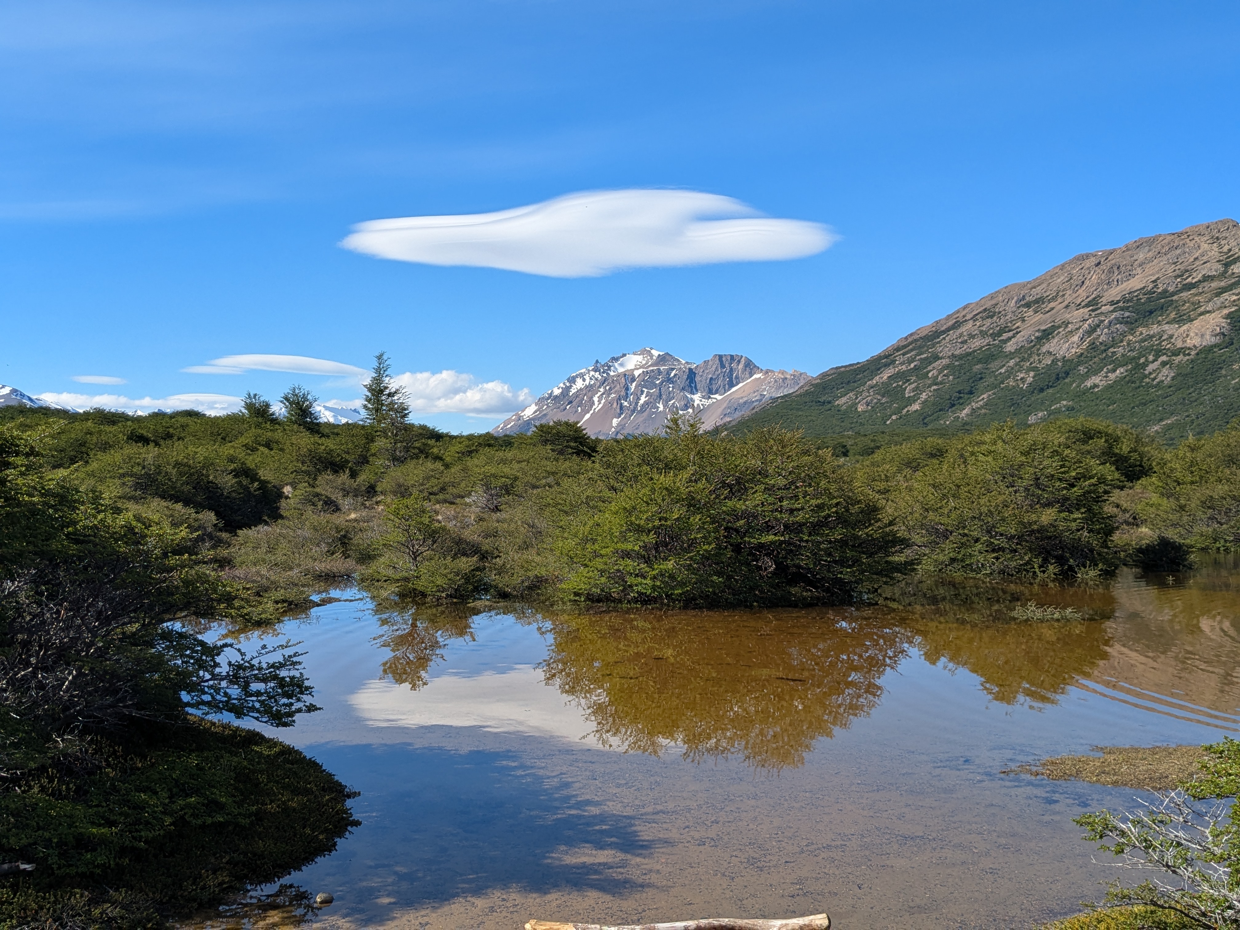
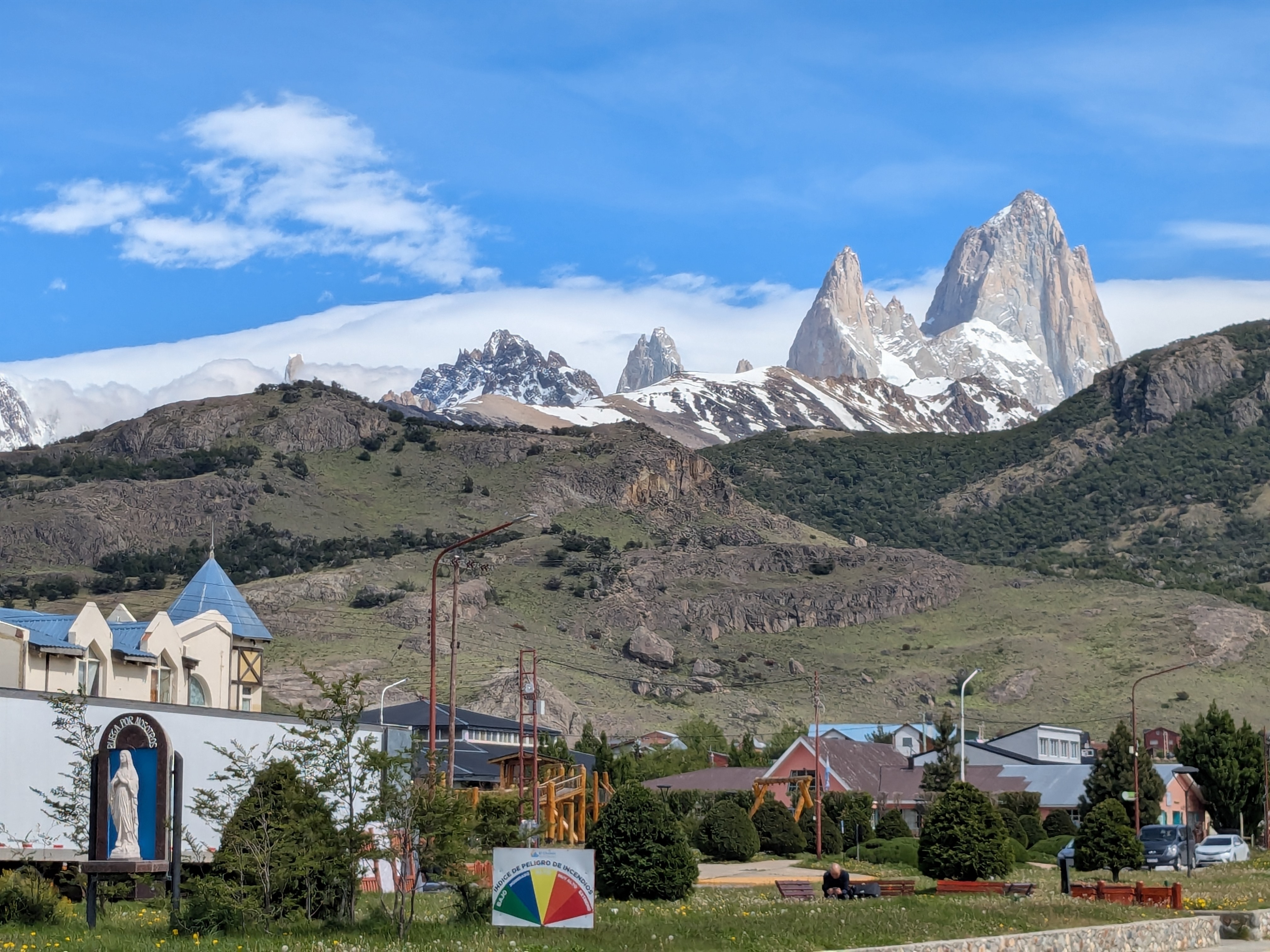
El Chaltén is a convenient 3 hours bus ride from El Calafate. El Chaltén has a different vibe and is like a village where visitors have just one thing in mind – outdoor exploration/hiking. It takes less than 30 minutes to stroll from one end to another. San Martín is the main avenue, not one of, in El Chaltén. Strolling in the town, we can see the different faces of Mount Fitz Roy from afar. The town is filled with hostels/hotels/airbnb, coffee shops, gift shops, grocery stores and choices of restaurants. Our Airbnb, a comfortable unit next to the host family, is in a perfect location.
El Chaltén’s itinerary is very simple – hiking followed by day(s) of rest.
A day after the arrival, we did the primary waterfall hike in El Chaltén, Chorrillo del Salto (Waterfall) to test our hiking gear. It is a relatively short forest trail, located at the north end of San Martin Avenue. It offers a view of, 20-meter high waterfall at the end. On the day, it was windy and dusty, creating a slightly unexpected challenge than an easy and flat trail that it is known for. After the hike, we went for an early dinner at a Parrillo restaurant, which displayed pictures of communist leaders Fidel Castro, Ernesto “Che” Guevara. “Che”, an Argentinian, has been a hero. “Las Malvinas son argentinas” is another discovery how some Argentinians still believe Las Malvinas (i.e. the Falkland islands) belong to Argentina.
Argentina Correo (Post Office) is undergoing changes so much that the Post Office looks terribly run down and it stays closed during opening hours. There are one or two gift shops selling stamps. To mail a postcard, it costs more than $10 USD, equivalent to 15000 Argentina peso, in 5 different stamps. I mailed two postcards. We then had lunch at the restaurant next to our Airbnb served with Parrillo lamb, salad, we enjoyed and had enough left over for dinner. Our star gazing plan faltered after knowing that the time for it would be after midnight.
Some travelers may have only one day to explore Iguaçu Falls. After spending a day in Argentina and another day in Brazil, we asked ourselves the question “which side would we go if we only had a day to spare?”
We arranged a one-day driver service for about $100 USD. The service includes picking us up from the Airbnb, helps us to cross the border to Brazil, drop us off at the Iguaçu National Park, and take us back to the Airbnb. It relieved us from the logistic distractions.
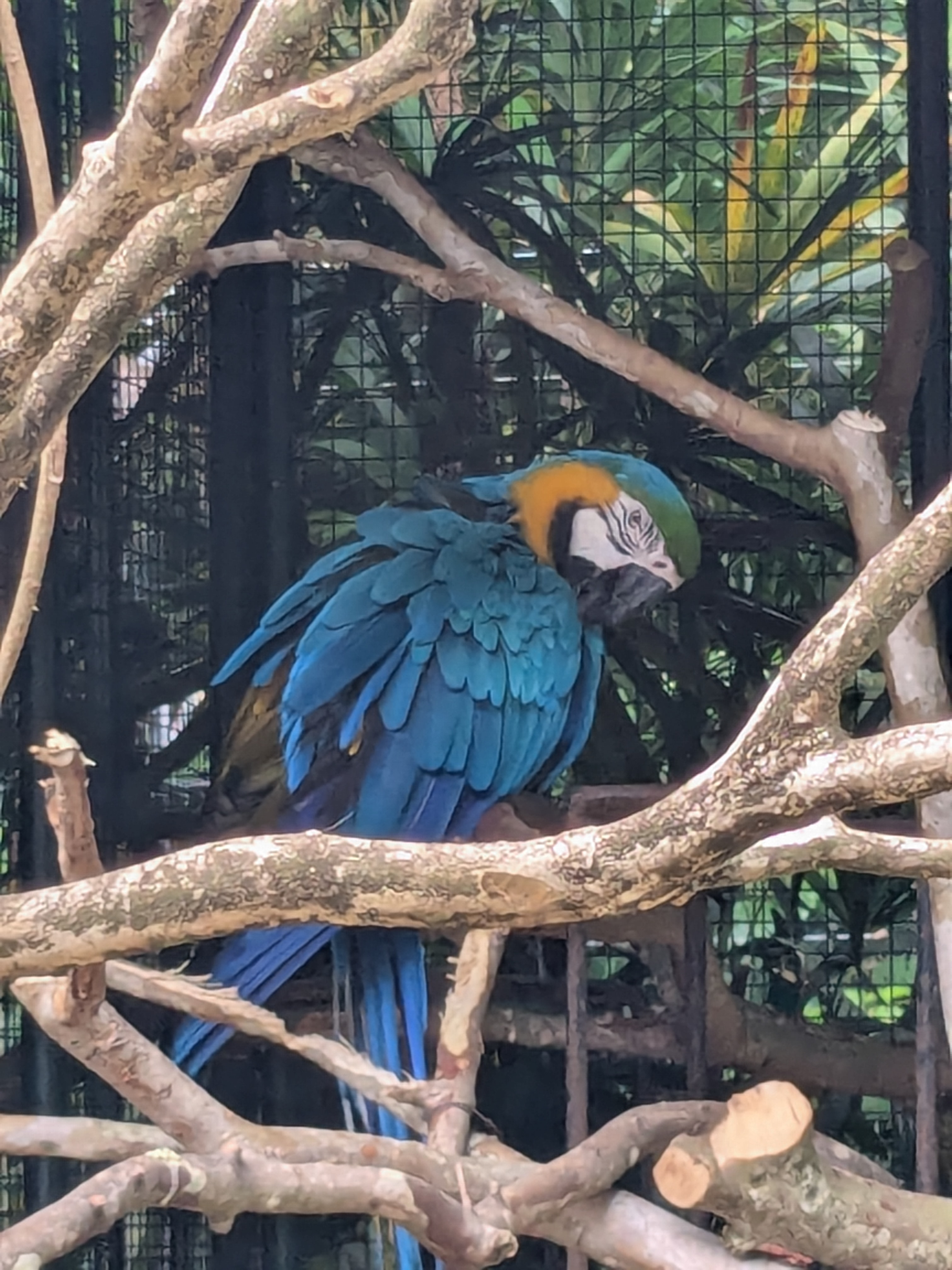
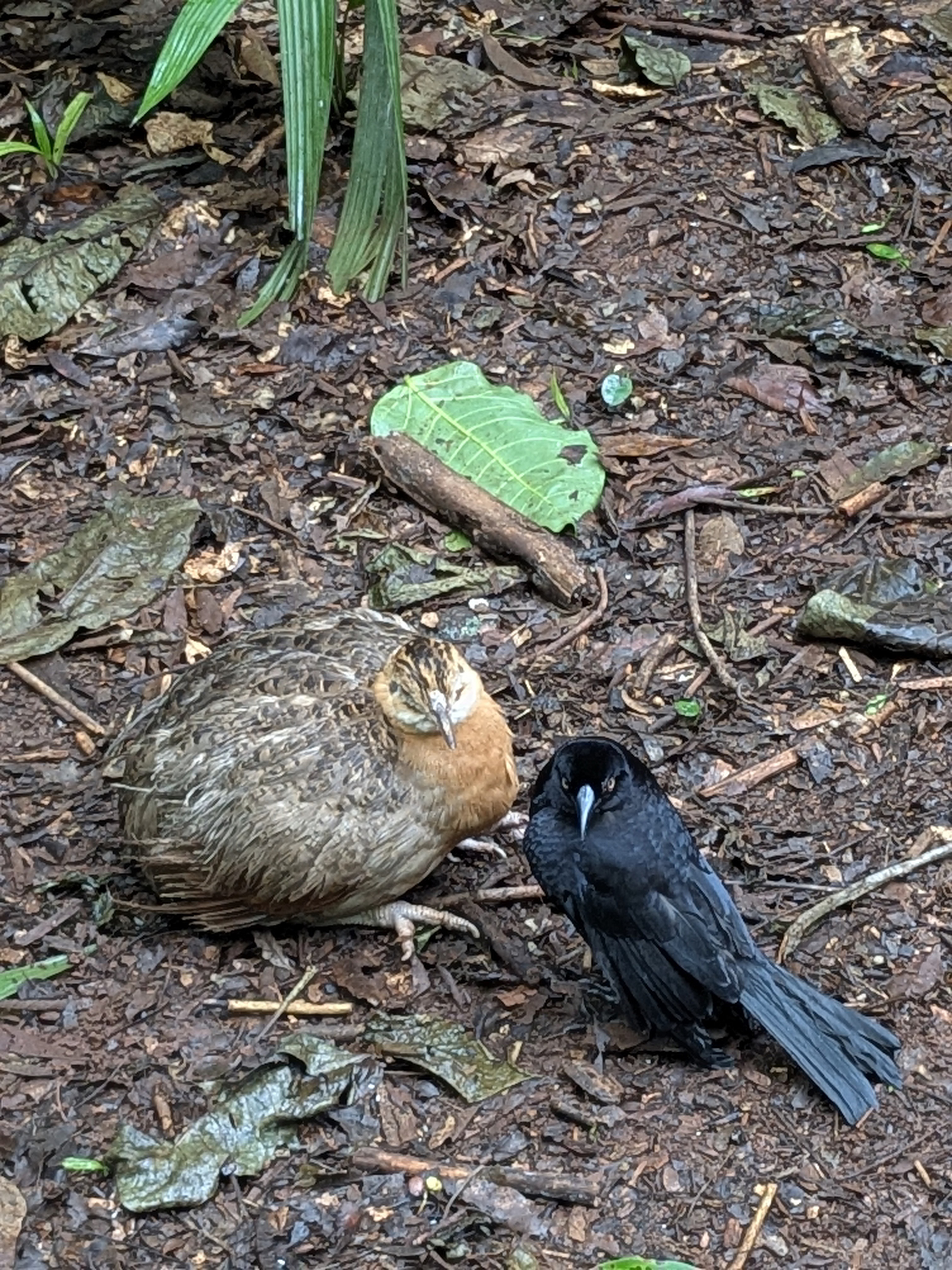
Across Iguaçu National Park, there is a bird park Parque das Aves. The bird park is among the best places for us to enjoy the exotic and colorful birds, not commonly seen in North America. Unlike its unassuming entrance, the park is well maintained showing great care to the birds. There are large aviaries and lots of spaces for the birds. There are restaurants and rest places for the travellers. The park is designed very well with beautiful flora, lots of educational signage along the trail and secure entrances/exits from one aviary to another. We ended up spending almost three hours in the park, appreciating the stylish Owls, the graceful Flamingoes, the beautiful Scarlet Ibis, the colorful Toucans, and many many more. We can spend more time there if not for the reserved admission time of Iguaçu National Park.
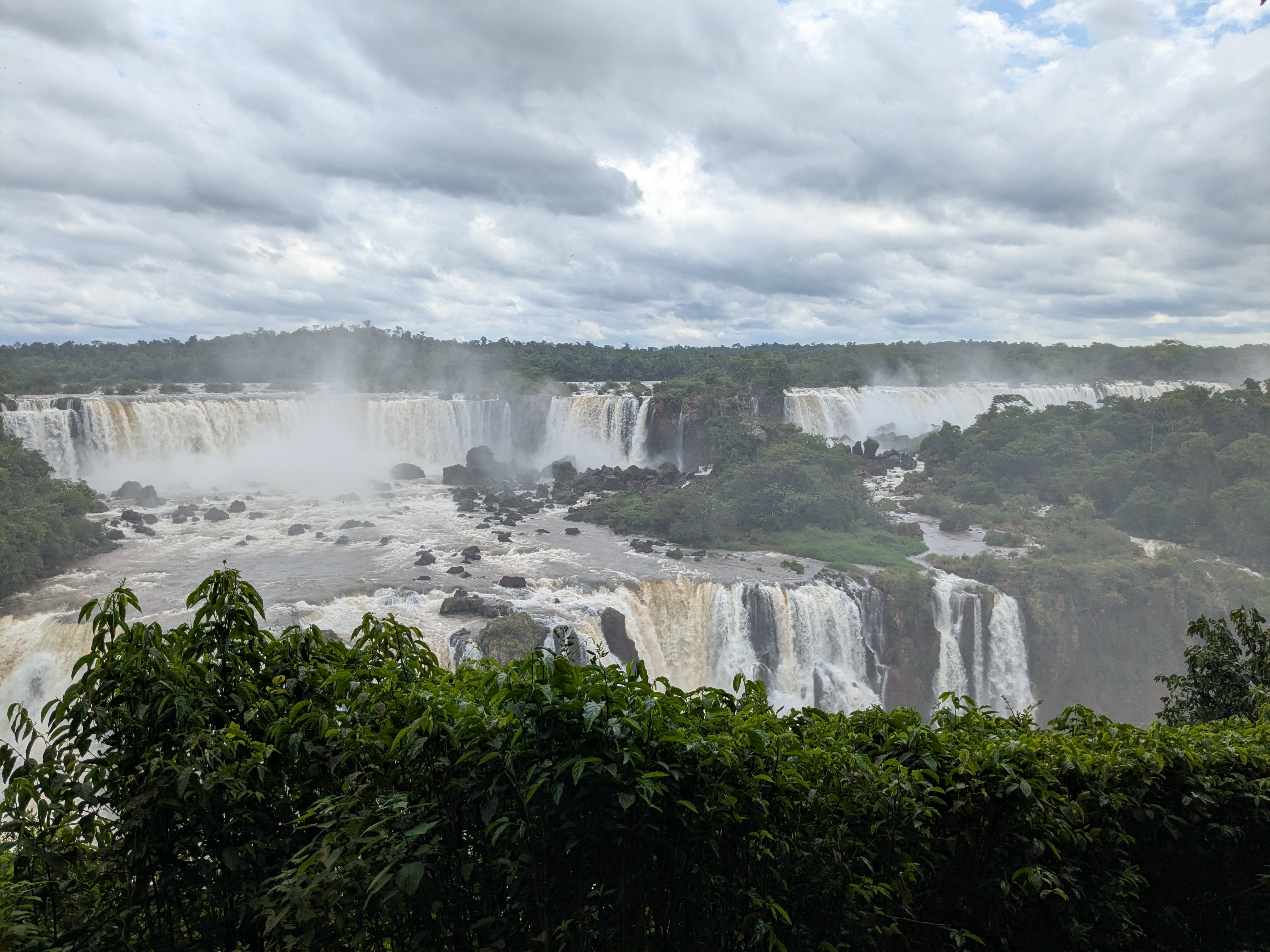
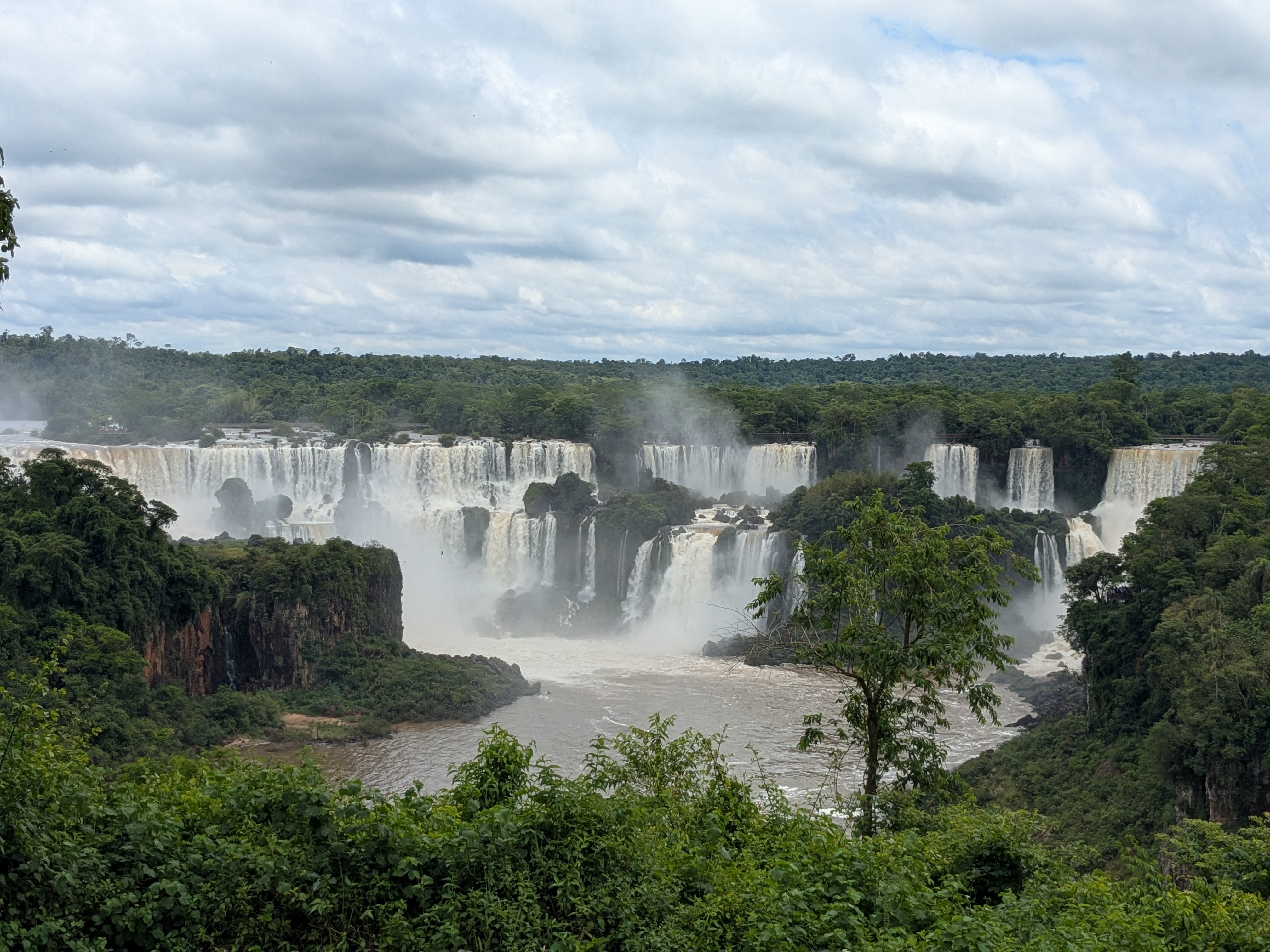
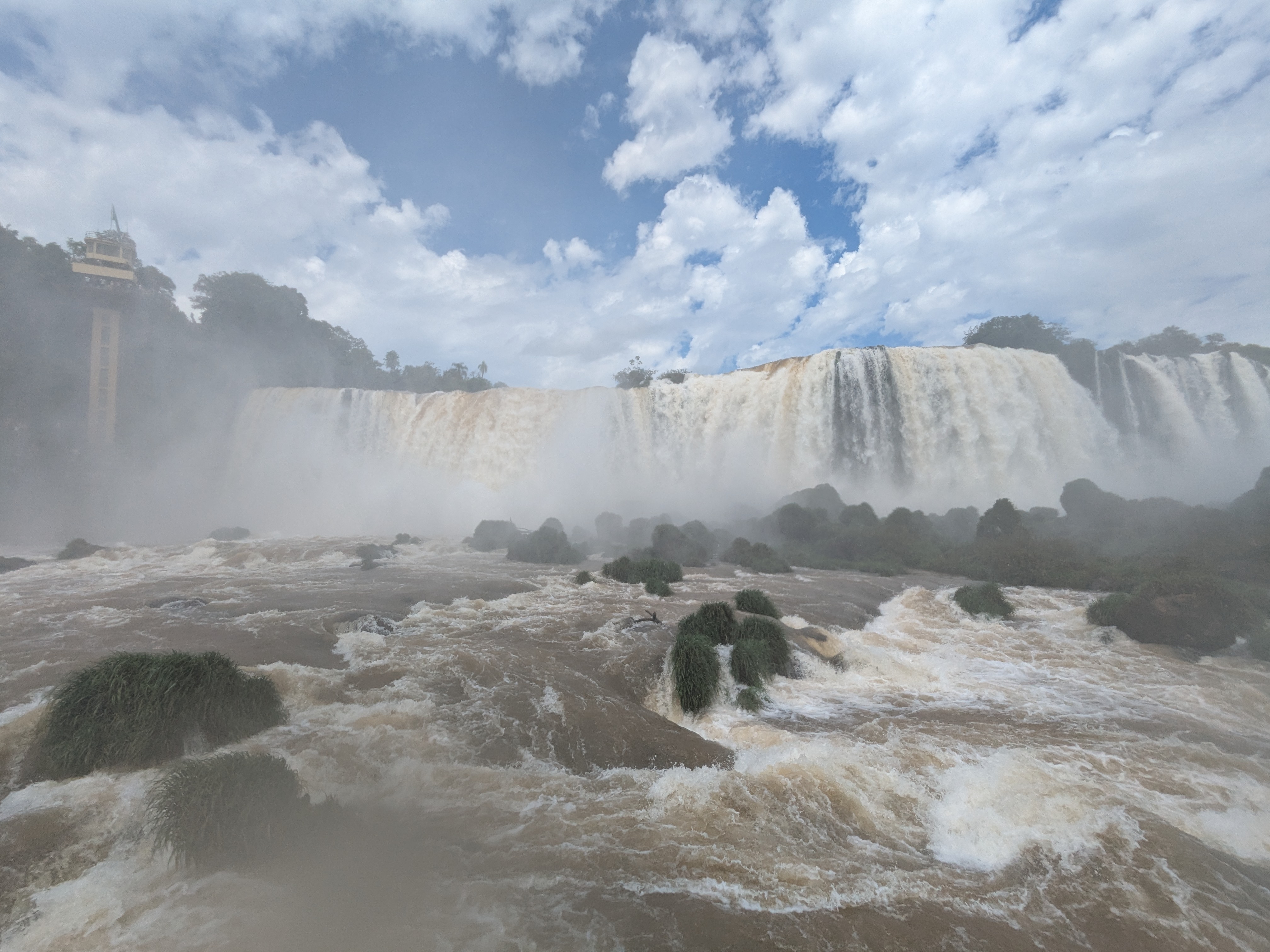
The logistics of Iguaçu National Park of Brazil are different from that of Argentina. In Argentina, helicopter service is prohibited due to environmental concerns such as noise level, impact to the animals. The Iguazu Falls National Park on the Argentina side is connected by trains and trails. In Brazil, there are helicopter services to see the falls and there are buses, with long queues, at the entrance to take you to a fixed number of stops in the park. We got off at the arguably most popular stop right across the Belmond Hotel das Cataratas inside the park. From there, there is an easy stroll full of photo opportunities of the Falls. This Brazilian side offers sweeping panoramic views of roughly 80% of the waterfalls located in Argentina and the staircase character of the falls. There are boardwalks to take you close to some individual falls to experience the waterfall mists and the winds. It was fun and wet.
So “where (which side) would we go if we only had a day to spare?” We think the Brazilian side has the edge with the amazing panoramic views to see its scale and the grandeur. For boat rides, Argentina has the edge. Our recommendation: It takes quite some logistics to visit Iguazu Falls. Why not spend more days in the biggest waterfall systems of the world?
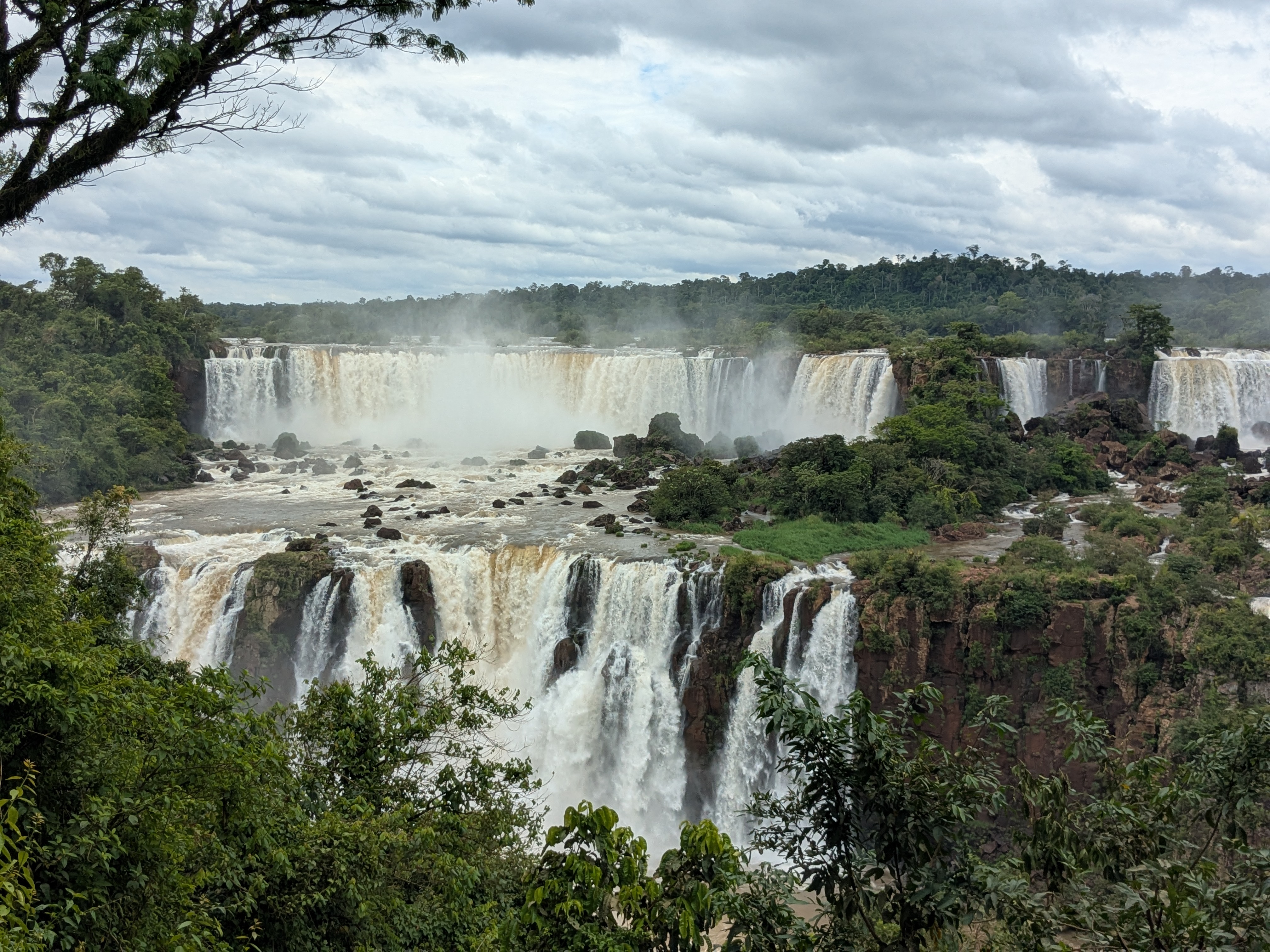
The Iguazu Falls (Argentina) or Iguaçu Falls (Brazil) are major tourist attractions in South America. Upon seeing Iguazu, the United States First Lady Eleanor Roosevelt reportedly exclaimed, “Poor Niagara!”. In November, we visited Iguazu and spent two full days there.
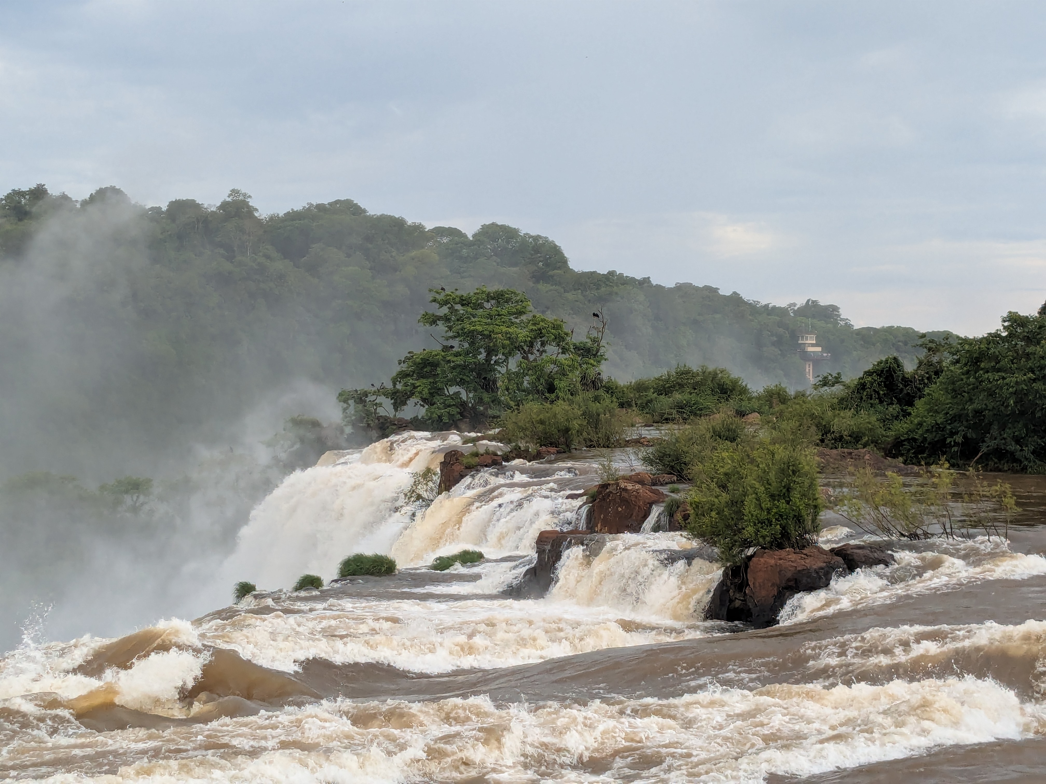
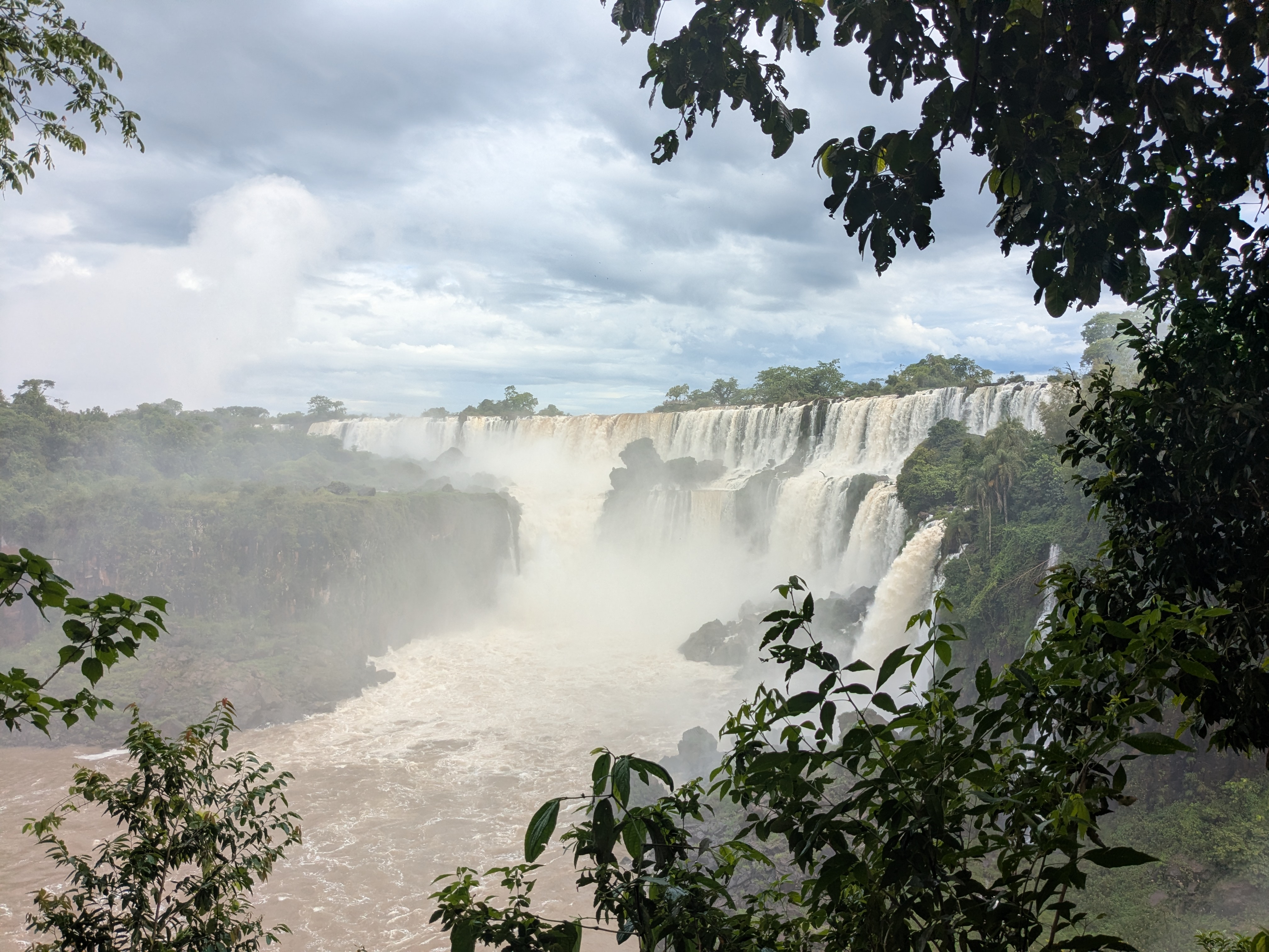
Spanning across 1.7 miles, Iguazu Falls are arranged in a massive, semicircular “horseshoe” shape and composed of over 200 individual falls. In comparison, Victoria Falls in Africa are 1.1 miles wide and Niagara Falls in Canada are 0.6 miles wide. The river of the Iguazu Falls is the Iguazu River, which flows from Brazil, forms the border between Argentina and Brazil, and then empties into the Paraná River, creating one of the world’s largest waterfall systems, if not the. About half of the river’s flow falls into a long and narrow chasm called the Devil’s Throat, along the Argentina–Brazil border. On the right bank is the Brazilian territory, which is home to more than 95% of the Iguazu River basin but has just over 20% of the jumps of these falls, and the left side jumps are Argentine, which make up almost 80% of the falls. From the Argentine territory, you have the chance to boat up close or hike up close to hear its thunder and experience its power. From the Brazilian territory, it is easier to take more impressive panoramic pictures of the 80% of the falls in Argentina.
A day in Argentina
It is a two hour flight from AEP (Buenos Aires) to IGR (Iguazu). Uber is not as consistently available in Argentina outside of Buenos Aires. At IGR, we met the taxi driver Ada who spoke bits and pieces of English phrases on the ride to our Airbnb. We understood each other well enough that Ada became our driver for another few rides. The ride from IGR airport to our Airbnb was very scenic with forest along the way and lots of butterflies hovering above the flowers paving the road. We were pleasantly reminded that November is Spring time in South America. The Airbnb is very spacious, modern and comfortable and it has a water dispenser which saves us the effort of buying bottles of water. There are restaurants and grocery markets within easy walking distances. The neighborhood seems more for locals than for tourists and lacks the camaraderie of fellow travelers.
The Iguazu Falls, on the side of Argentina, reside in the Argentine province of Misiones, and make up close to 80% of the falls. We had a reservation for a 3-hour boat ride, including jungle transport to the river. The open-top jungle transport was a comfortable ride. There were birds chirping, we saw colorful Toucans and enjoyed the forest as we rode through the jungle with fellow travellers. The tourist guide explained everything in both English and Spanish.
After hundreds of stairs going down, we arrived at the river, were given life vests and a big waterproof bag, to put everything in, and were reminded that no raingear would save us from getting soaking wet. Then began the boat ride. The first leg was on a quiet river flow. Soon, there were individual waterfalls and more waterfalls. As the boat approached the waterfalls up close, it felt more like a roller coaster ride, except this ride, we were under the waterfalls. At times, it was like being in a shower. At other times, it was like being “hit” by powerful water jets. We got soaking wet and the boat kept going back to be under the waterfalls. When we had enough, the boat was back to the quiet river again and we headed back to the jungle. It was cold, fun and exciting. If you go for the boat ride, just remember to bring a spare set of clothes, unless you want to spend the remainder of the day in wet apparels.
In the afternoon, we took the slow moving and comfortable train ride in the park, and did the popular hikes : the Devil’s Throat trail first, and then the Upper Circuit, Lower Circuit. The Devil’s Throat trail leads to the most powerful section of the falls with well paved suspended walkways. At the Devil’s Throat, we were level with the waterfall, hearing its thunder and feeling its mist as the water jumped down the 200 feet canyon. The Upper Circuit allows us to see the waterfalls from above. The lower circuit allows relaxing stroll on boardwalk over the river, and gets us close-up views from below. There were many many individual waterfalls we visited along these hikes. These hikes, some with stairs, are overall friendly to travellers of different degrees of fitness.
The boat ride, the trains and the hikes offer stunning and varied perspectives of the falls.
I was single. I brought my tennis racket when I went on business trips to the US. That was the Ivan Lendl era. That was a long time ago. Many things have changed including having two children in their twenties. The Roger Federer era has come. The next generation of Alcaraz and Sinner rivalry is just at the beginning. What has not changed is I still enjoy tennis. I cannot catch up on the years lost during the years of child rearing. I have not given hope. I hope I can get back to the game and play more.
This year, my spouse and I signed up for a Nike Tennis Camp at Pebble Beach. We were very looking forward to it, until it created a conflict for the WAVE hike. We finally made the Tennis Camp the last weekend in October. The camp is for intermediate level, for people at or above 3.0 in the play scale. The few weeks before the camp, we played once or twice a week in practice, so as not to embarrass ourselves. I enjoyed the practice, clearly my shoulder and my tennis elbow both gave some whisper that it could become noisy with more playing.
The Pebble Beach Lodge is pricey and can be over $1000 per night. Considering the little time we would stay inside, we found a nearby Airbnb in the Carmel area.
The Airbnb host gave us permission to check in an hour early before we checked in to the Tennis Camp on Thursday. This Airbnb check-in turned out to be the simplest ever, there was no passcode, no key, we passed two garden gates, and walked in. The host left a guidebook on the table, giving us everything to know about restaurants, spas, markets. We could tell the unit has some years on it, but it was well maintained inside and outside. There was a small backyard, which made a great small BBQ party during the warmer season. In autumn, the inside of the unit looked more inviting. We did not have much time before checking into the Tennis Camp in the afternoon. Little did we know the simple check-in turned out to have a catch. More on this later.
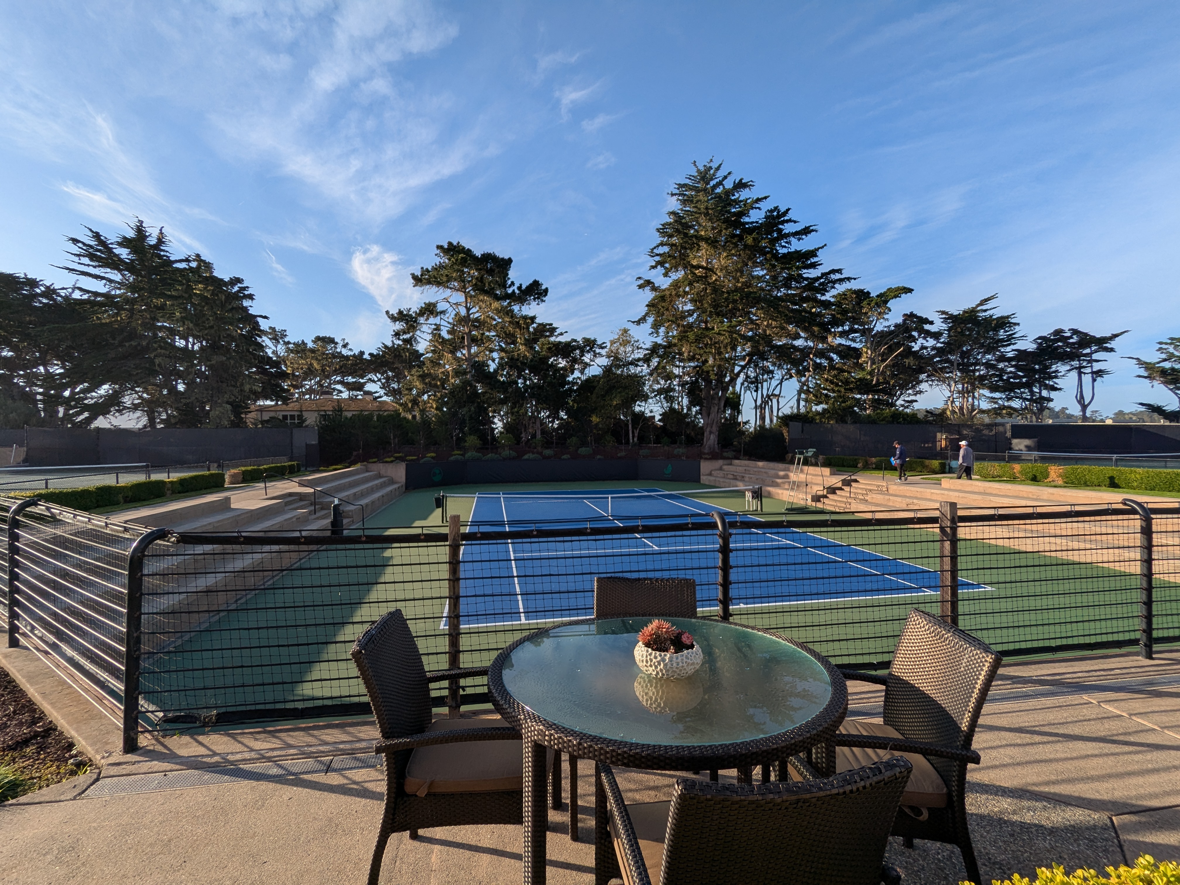
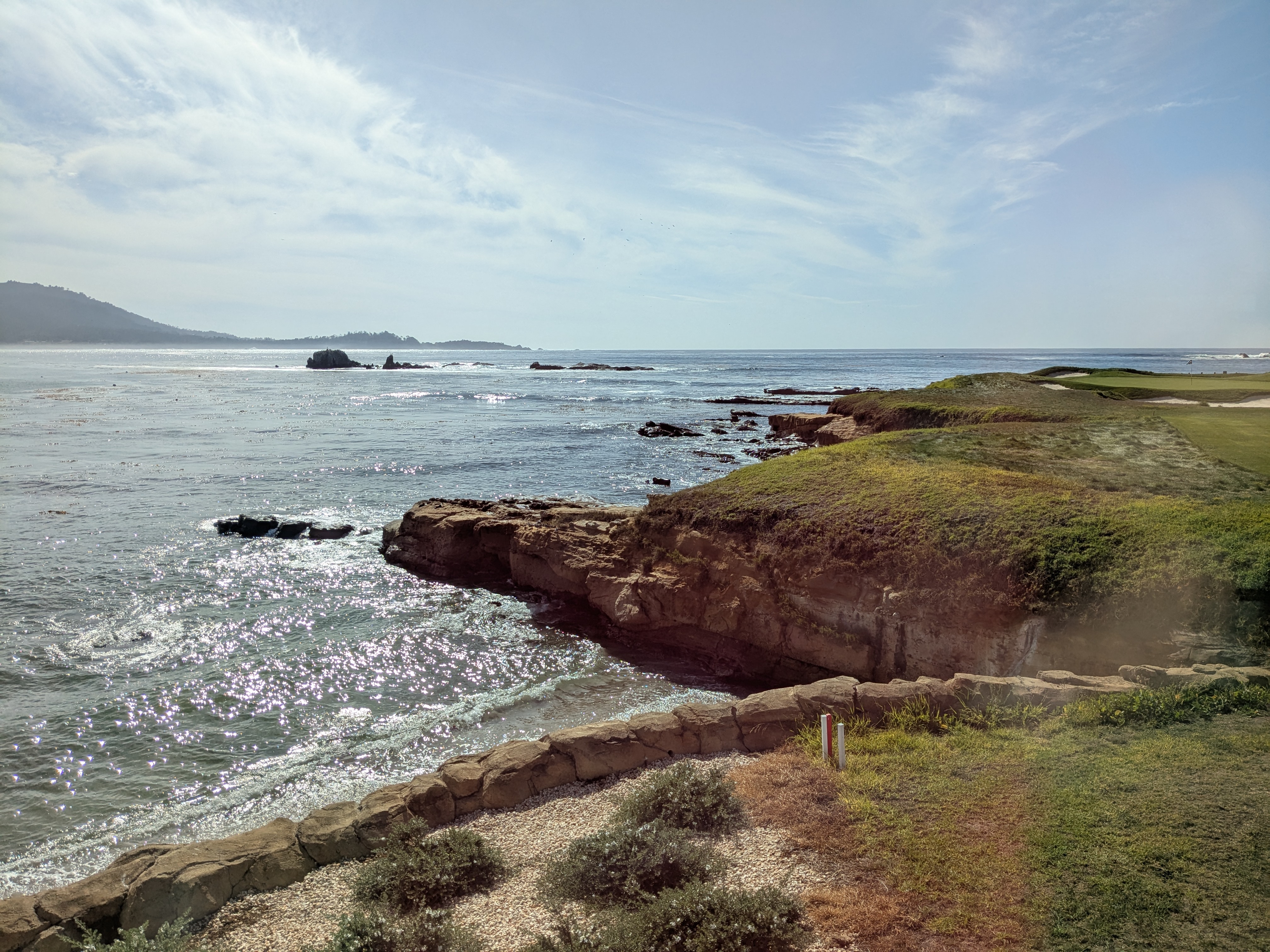
We need to go through the scenic 17-mile drive, a toll road, to get to the Tennis Camp. The codeword to drive on the 17-mile scenic drive for free is “Tennis Camp”. The Tennis Camp area has many well groomed courts, including a couple of clay courts, and a tennis store with friendly staff. The tennis area is right next to the beautiful Pebble Beach golf course, along the Pacific Ocean. The you-know-what-number hole is right next to the parking lot of the Tennis Camp. For the weekend, we felt at home in the Carmel and Pebble Beach neighborhood. We experienced the feeling of living in the beautiful area.
The camp goes from Thursday afternoon to Sunday morning, giving us a 2-hour play on Thursday, a full-day 9 to 4 play both Friday and Saturday. If that is still not enough, it includes a Sunday free play too. We checked in the Tennis Camp and met other fellow players. Many gave subtle messages that they came to play tennis not for social reasons. We were among the few who were rookies to Tennis Camps. These Tennis Campers were not particularly enthused in making friends, except for a few that came in singles, who may have a different agenda. All-in-all, all the campers love playing tennis and can play hours of tennis.
We were sent to a court to join another 2 players to play doubles. After a few rotations on the courts in the afternoon, we got a sense of the playing levels. Most other players had better double techniques, played regularly, and often played in some forms of ladder. My serving skill and ground stroke is not too scrappy either. Most campers are from the Bay Area. There was one group from Canada. Most came with friends. There was one 20-something who came on his own. He was the best in class. On the last day of the camp, he beat one of the younger coaches. My spouse and I were arguably the most obvious recreational players. We hardly played doubles. We hardly play for the past years, other than in the few weeks prior to the Tennis Camp. We never play in a club. Yet we can play. Tennis players were famous for their competitiveness on court. We observed a few. I was both anxious and excited. My major anxiety is whether my shoulder and elbow could hold up throughout the camp. I would later find out.
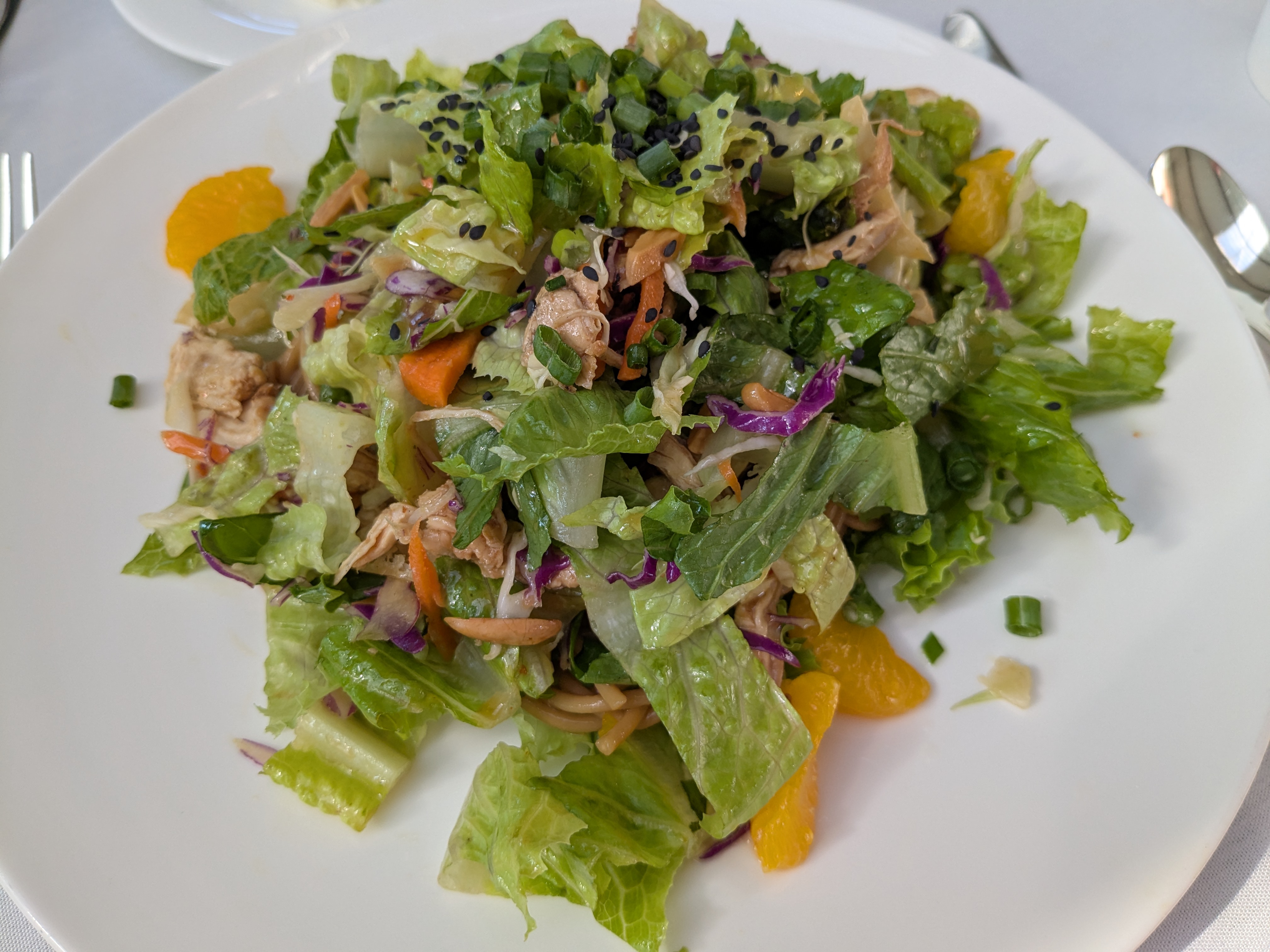
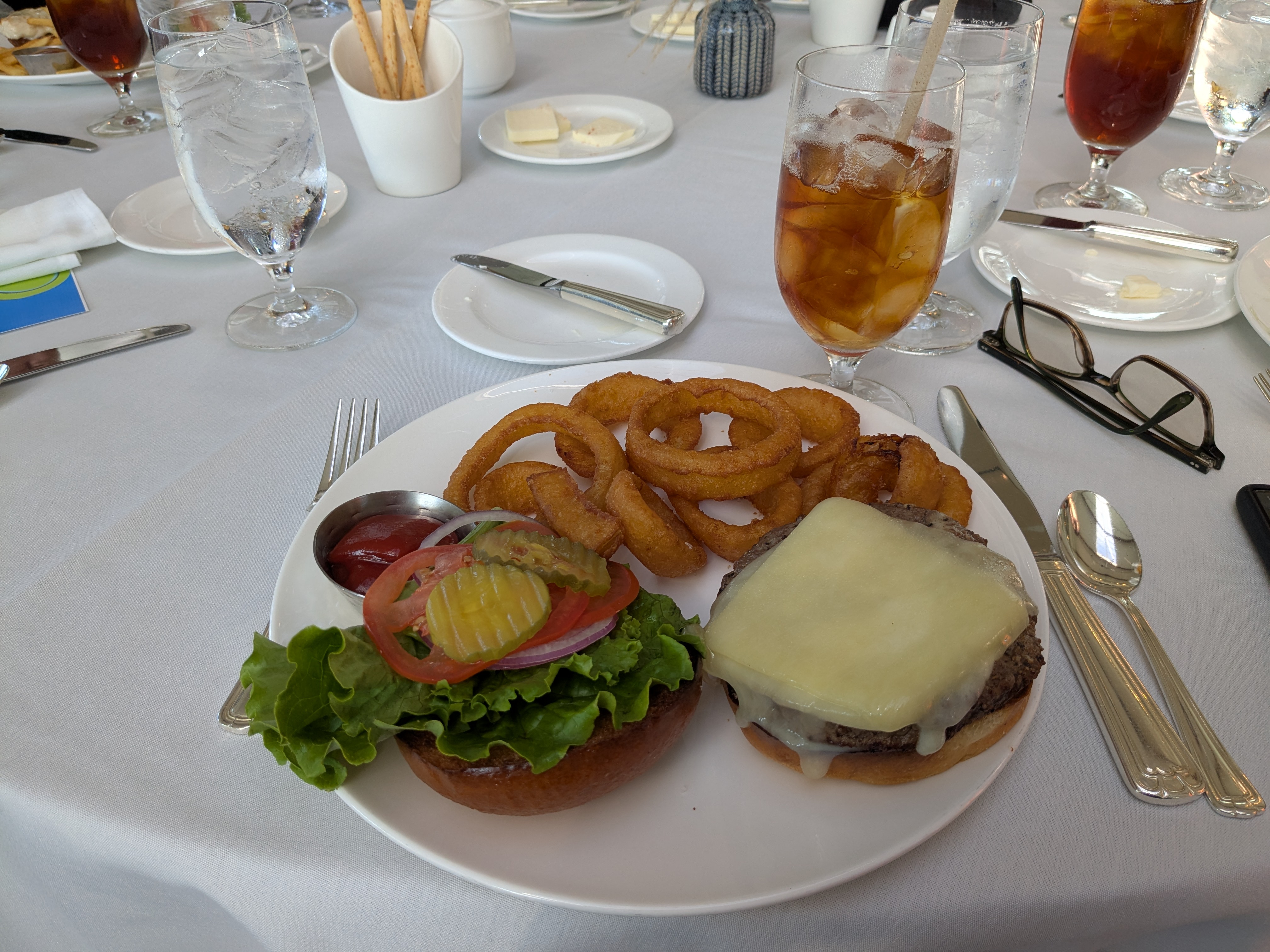
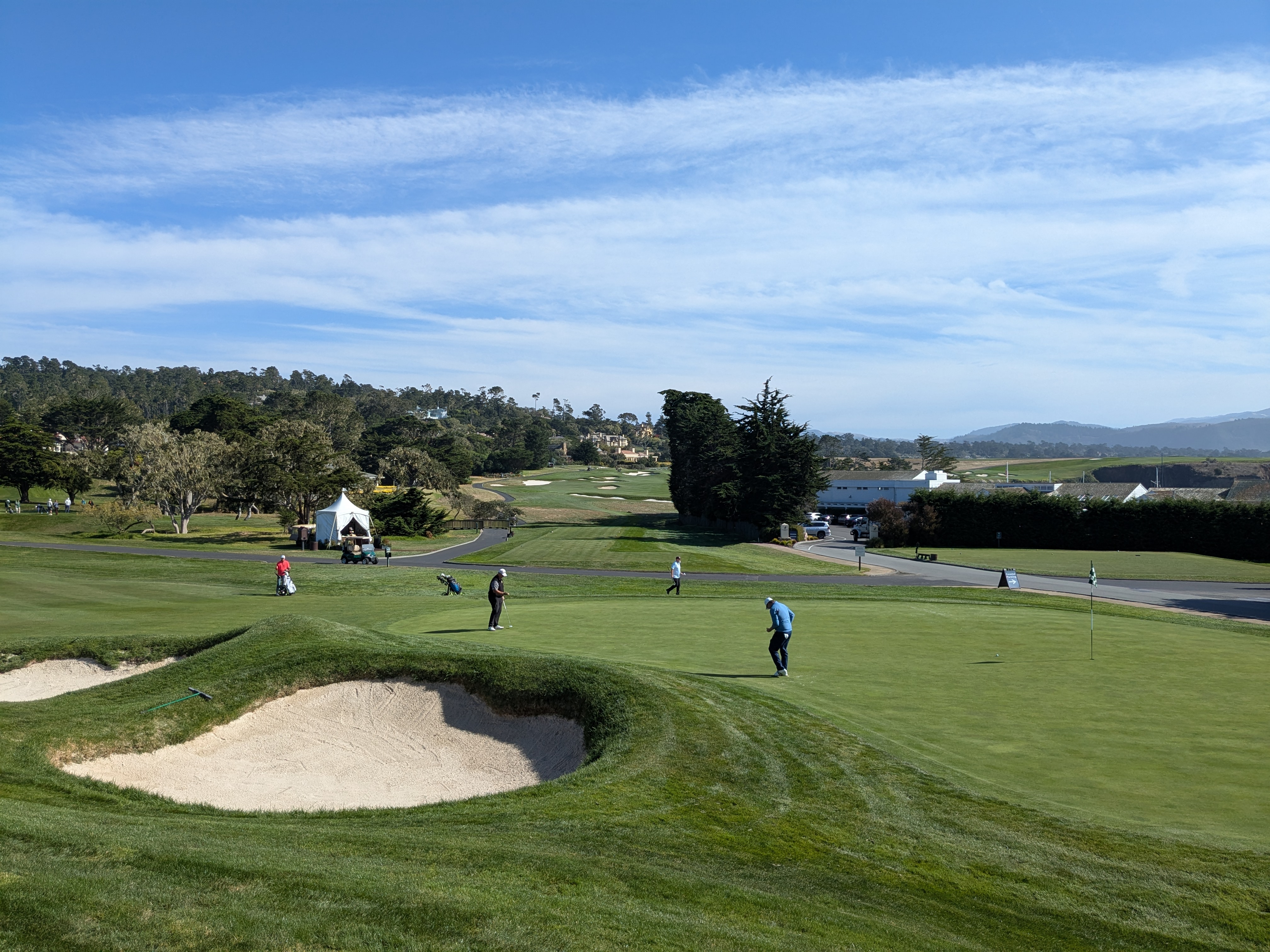
When we returned Friday morning, each of us were set up to rotate over a number of coaches. Each coach focuses their 30-minute sessions on different techniques, from serving, ground strokes, rally, overhead, to strategies. After about three hours, we went to the Pebble Beach clubhouse for lunch. It is about a 10-minute scenic walk besides the famous golf course. The Pebble Beach clubhouse is usually reserved for members. The Tennis Camp has made special arrangements to get us in. Lunch is good. The view of the Pacific Ocean and the 18th hole is memorable. We took as many photos as possible while respecting the privacy of other diners.
Out of the blue, I got a call from our Airbnb host while enjoying the delicious lunch at the Pebble Beach Clubhouse. I was informed that we checked in the wrong Airbnb unit. Could there be a bigger OMG moment? We checked in the unit next to our assigned unit. It was a better one. We were embarrassed yet relieved to find out “our” unit was available, and the host gave us a “free upgrade”. After a few days, I gained enough courage to find out whether it was our mistake or it was an instructional error. It turned out to be the latter. Despite this gaffe, both the host and I gave 5-star ratings to each other.
After the scenic lunch, we were back for our afternoon. The afternoon started with coaches playing in doubles with each other, to walk us through double skills and tactics. It was particularly insightful for us, non double players. There were three choices afterwards: a single group, a clay court group and some other groups. We decided to check out the unusual combination of clay courts, California and Pebble Beach. We enjoyed the experience. My shoulder and elbow held up barely, and that got me anxious about Saturday.
The Tennis Camp ended each day before sunset, leaving us the evening to enjoy. Carmel-by-the-sea and the Pebble Beach area are great places for great restaurants. We had one of the best Italian food at the La Bicyclette restaurant.
Saturday started about an hour late, due to the rain. The morning was similar to the day before, and we were sent to a number of 30-minute sessions. The rotations were such a great setup, I could come back to the camp, just to pick the brains of the different coaches. We had a shorter lunch to make up for the late start. Everyone brought their own lunches. The afternoon was competitive, where we matched with different doubles partners and played different opponents. We played 10 games each. Every game we won would count towards our score. The one with the highest scores got the bragging right. We did not play every single person. The camp organizer was thoughtful to match us with people of similar levels, to make the matches competitive. My hands hardly held up. Every server was a doubt and almost a struggle. I did not want to disappoint my double partners. As such, I ended up serving the best in my own life, despite the situation. I scored some games, but far from the winner of the contest. It was a beautiful moment in that group picture. My body somewhat held up. I learned so much about the doubles positioning, and so many other tips we could put in our single play. As a tennis lover, it was just a treat to have a chance to play tennis and only tennis for the last three days.
We were treated to a group dinner at the Inn at Spanish Bay. The dinner tab was included in the Tennis Camp fee, yet the menu and the wine provision were generous. After watching the beautiful sunset, we arrived at Roy’s at the beautiful The Inn at Spanish Bay. We settled in one of the tables. Most campers took some time to change to their dining dress code. They looked so put together that it took us a while to recognize each other! The food was so good. The ambience was memorable, the conversations flew. We spent so much time on tennis courts for the last three days. After the dinner, we were on different paths again.
My spouse and I are enthused to put the tips in practice, play more. We would love to be back in another tennis camp, likely in another beautiful venue.
Truth is the first few weeks after the camp, my shoulder was giving me fits. I had to patiently wait for its recovery. After a few more weeks of slow-as-nail improvements, I decided to check it out. I was suggested to do a few therapy sessions to strengthen my shoulder muscles. Luckily, there was no injury. Rather, I overused the shoulder muscle.
Tennis Camp at Pebble Beach is a once-in-a-lifetime experience. Few things are more rewarding than spending time doing something you love for hours and days.
I enjoy playing tennis. I am patiently waiting to play more and more.
In September, we did the Wave hike that only a rare few have ever experienced. In October, we did our first ever 3-day tennis camp at the beautiful Pebble Beach, California. In November, we had our 3-week “longest” visit to NYC.
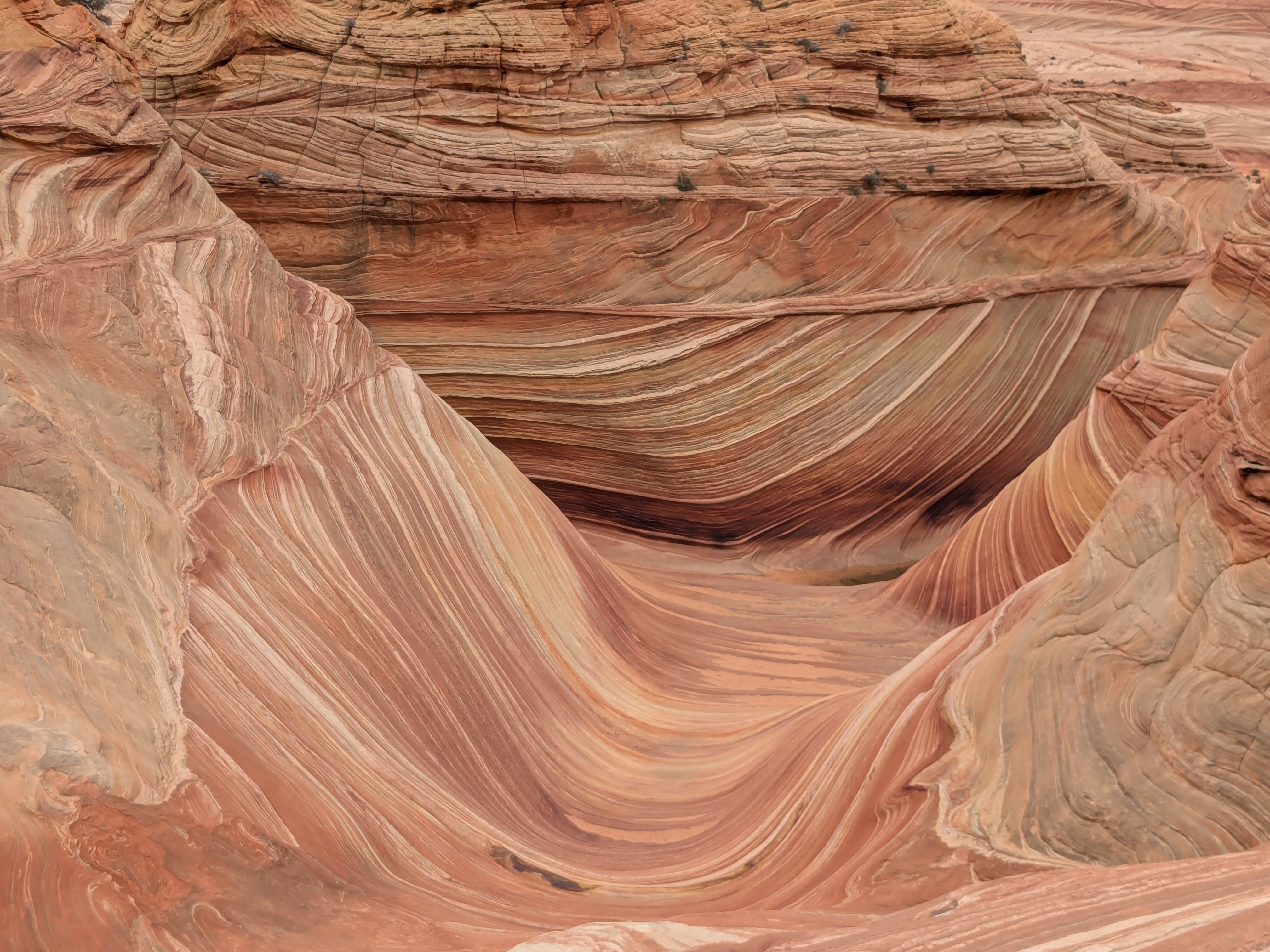
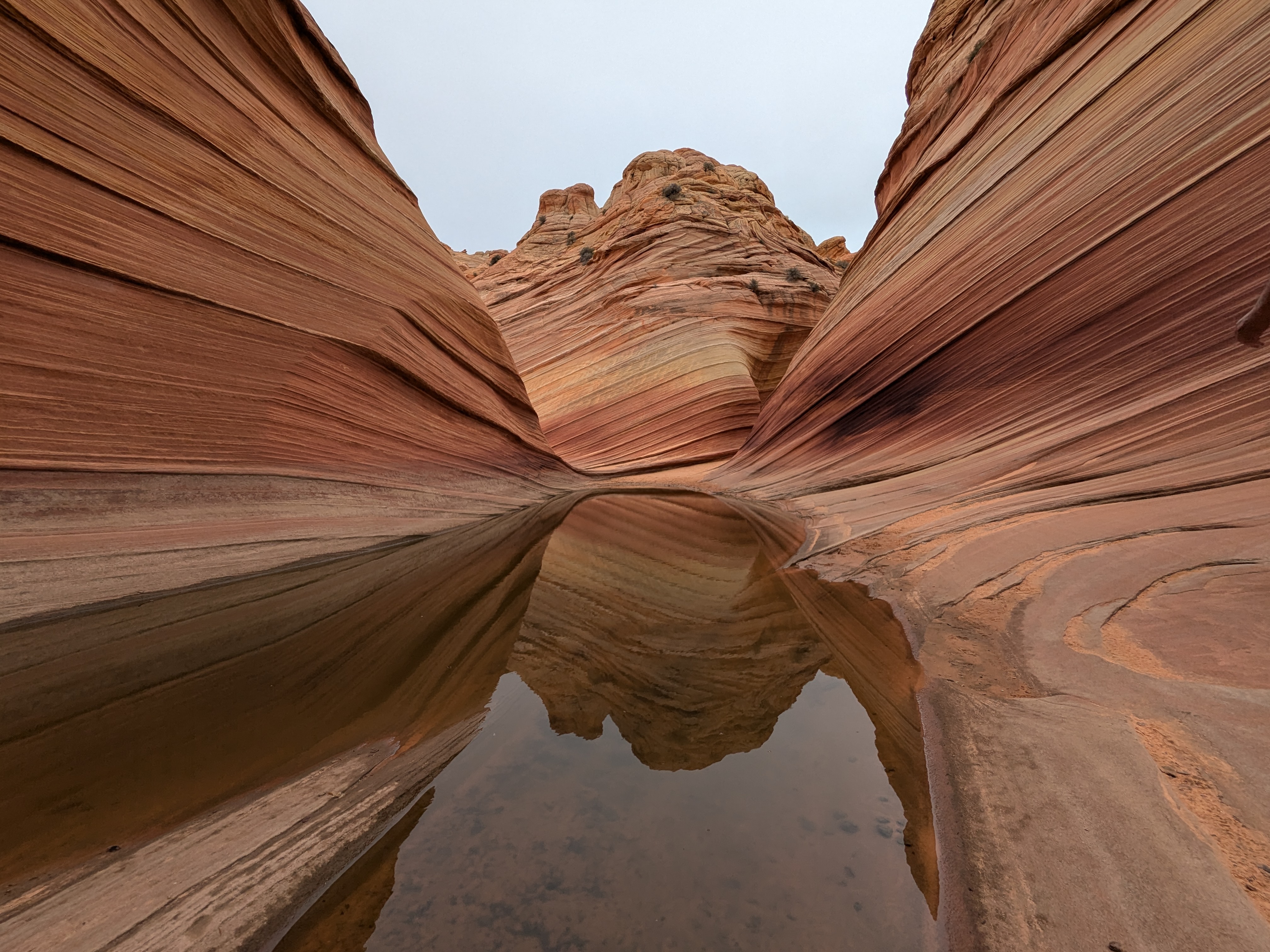
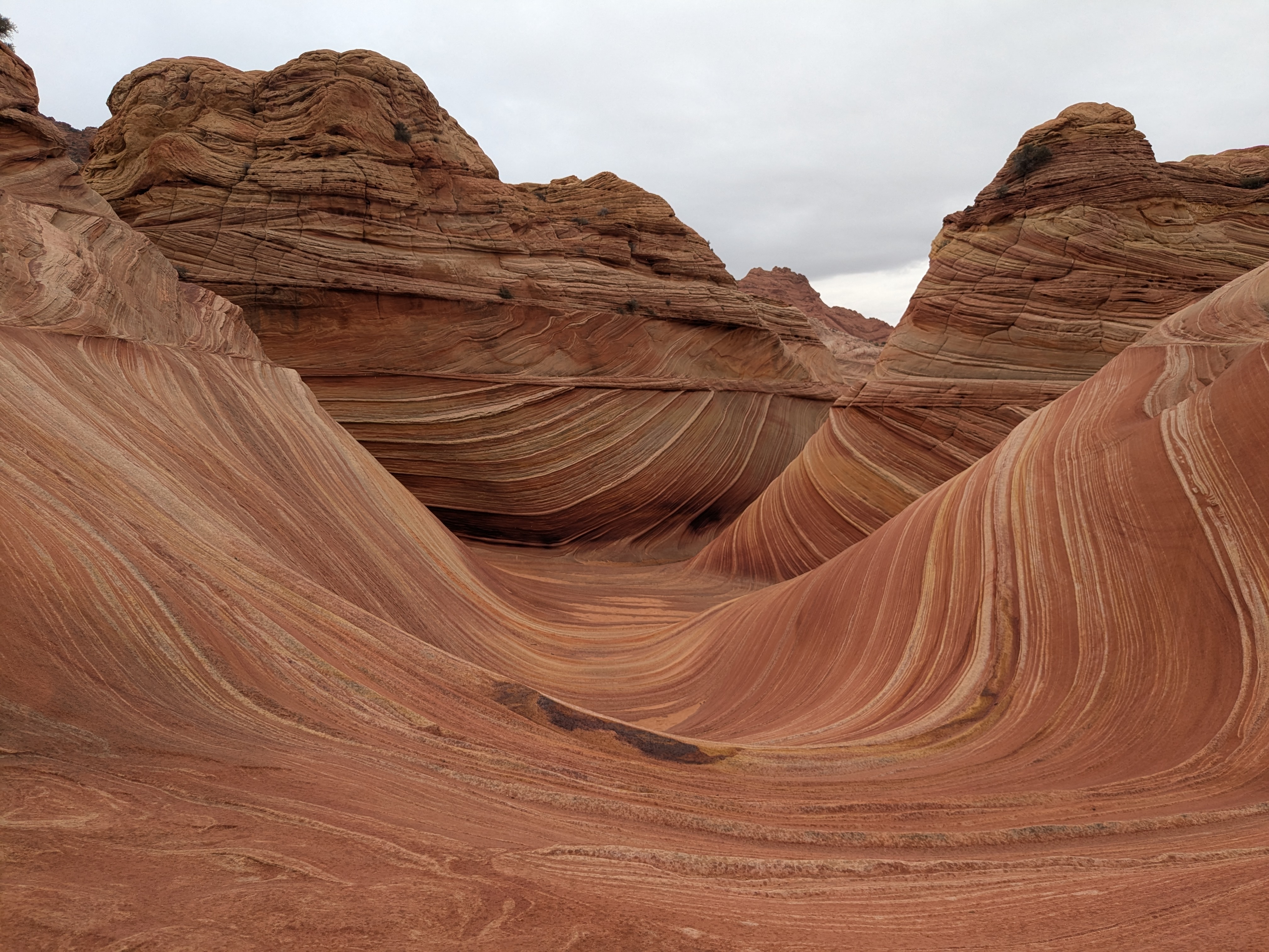
The Wave makes a dream destination for hikers. It is otherworldly, unique and unforgettable that I can stay there for days, and still be in awe of its natural beauty. Its photo tells a thousand words, but it pales compared to in-person experience.
The Wave in Arizona became widely known after Microsoft featured it as the default desktop wallpaper for Windows 7 on July 22, 2009. Fast forward fifteen years, many recognize the pictures but very few know about the place even fewer have visited the Wave. Why? It may have to do with its being managed by the Bureau of Land Management (BLM) rather than the more well known National Park Service (NPS). It may have to do with its accessibility.
The Bureau of Land Management (BLM) manages the Wave. BLM manages one in every 10 acres of land in the United States, including vast stretches of desert, grasslands, sagebrush steppe, coastal areas, and some forested lands . The National Park Service (NPS) manages US National Parks. The Wave is not part of any national parks. BLM and NPS both oversee public lands in the U.S., but their purposes and management differ. BLM manages vast areas of land (mostly in the western U.S.) for multiple uses, and emphasizes a balance between resource use and protection. BLM often leaves the wilderness alone where you can explore. There is no lodge, often no marked trails, lucky to have a parking lot or restroom. You are more on your own.
NPS, which operates many world-renowned U.S. National Parks, offers recreational enjoyment while prioritizing conservation and strict protection. National Parks are more developed with visitor centers, with more infrastructure, more facilities, more accessibility and designated hiking trails. NPS makes the park enjoyable for generations while preserving them.
BLM operates Coyote Buttes, which includes The Wave, and limits visitation through a permit system. The Wave, being operated by the BLM, stays intact over millions of years. With only a daily maximum of 64 people getting the permit to explore the area, the human footprints are kept to the minimum. The least human footprints help the highest order of preservation. The Wave permit is hard to impossible to get. The permit can be obtained through an advanced lottery system, or a daily try-the-luck walk in. The advanced lottery system is simple. It opens four months before your trip date. You have the whole month to apply with a maximum of three preferred dates. The lottery is now open for April 2025 Permit.
My first recorded lottery was dated March 2020. I did not try every month, as summer could be dangerously hot and winter could be harshly cold in Coyote Buttes. I only drew for the months with more forgiving weather. I did at least six attempts in the past four years. On June 3, 2024, I received this email: “Coyote Buttes North Advanced Lottery (The Wave) Lottery Results Announcement – Congratulations!”. It was an amazing feeling of a long forgotten dream coming true when I least expected it. Many tried for years, even decades, and are still trying. It is the closest we ever get to the Wilderness, seeing the same sceneries as the dinosaurs. There is no way that I will pass up on this. We accepted the lottery results.
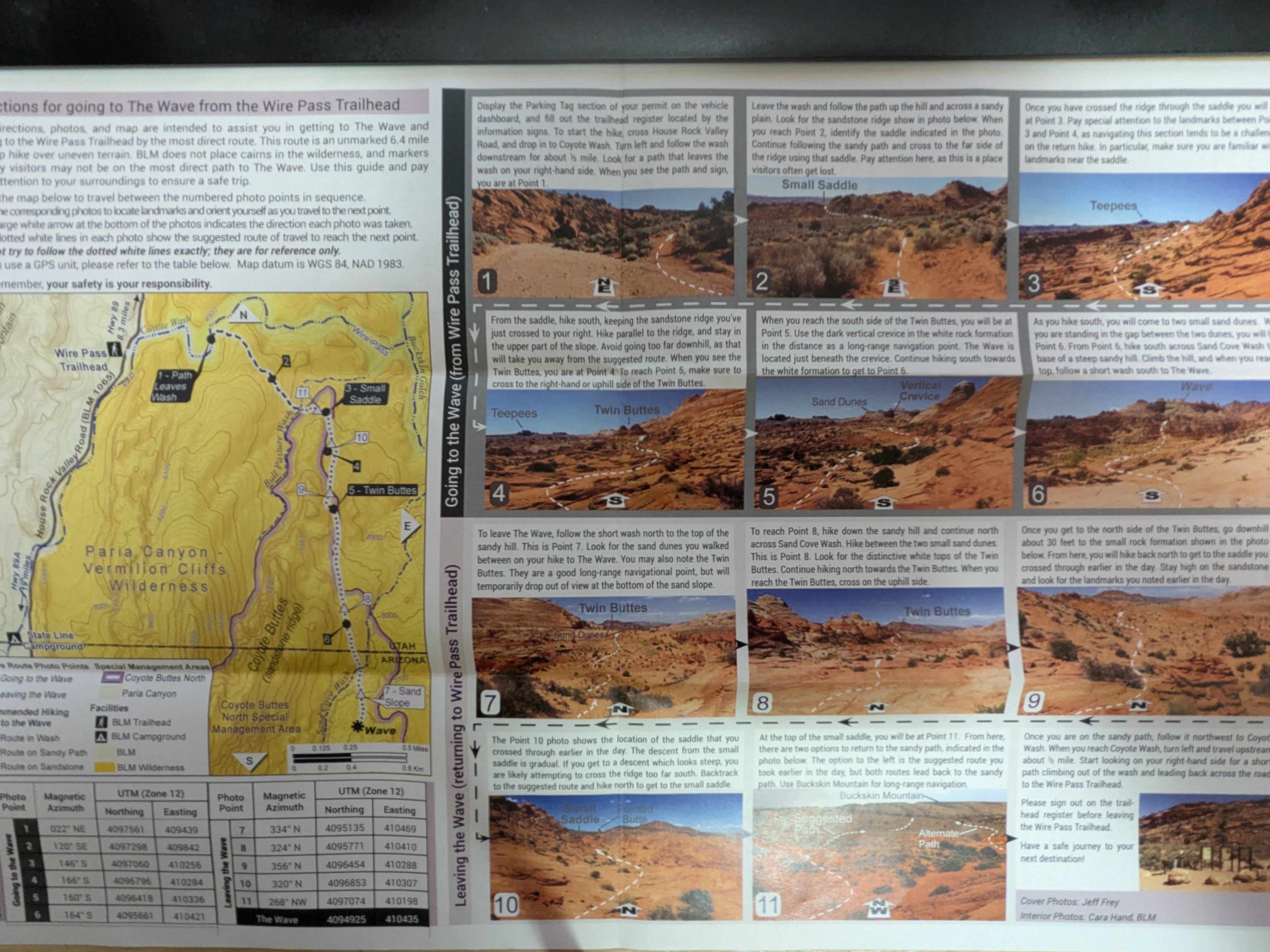
A few weeks after accepting the winning lottery, BLM mailed us the permit and some directions for going to the Wave from some trailhead. It was like eleven pictures with detailed descriptions we can use to get from the trailhead to the Wave. It even states that markers placed by visitors may not be on the most direct path to the Wave. If we miss a picture and a turn, who knows when we will discover the miss and then backtrack. In short, we are on our own. We are too old to feel that getting lost, without a functional cell phone to contact outside, is an adventure. The Wave, as beautiful as it is, can be challenging and life threatening. It needs wayfinding skills and decent physical fitness to navigate through the vast wilderness. We are not confident wayfinder in the wilderness. We need to carry at least a gallon of water in a terrain of mostly sandstones. Even with the information provided by BLM, we decided to find a tour guide. The tour agency is very clear that we need to be prepared to walk 7+ miles in the rocky desert terrain, exposed to the elements. (In hindsight, we probably can figure out the navigation with some misses and backtracking, but then we will be focused on the navigation than the landscape)
My group of 4 had three months to get fit. We started our once a week training hike to get fit. From early August to a week before the Wave, we did 6 training hikes at Coyote, Upper High Meadow, and Stephen E Arbors Loop at the popular Rancho San Antonio of South Bay. The 4 hour training hike covers 8.4 miles with 1686 ft elevation. That is not quite the 7+ hours Wave hike. To build more confidence, I also did some stairmasters during the week. We felt ready.
The Wave has an elevation of over 5000 ft. We arrived at page, Arizona a day prior to the Wave hike. It helps acclimatize to the elevation. There is just so much to do at Page, Arizona and its proximity. We did a short beautiful hike at the Beehive Trail, sometimes called the New Wave. We felt ready.
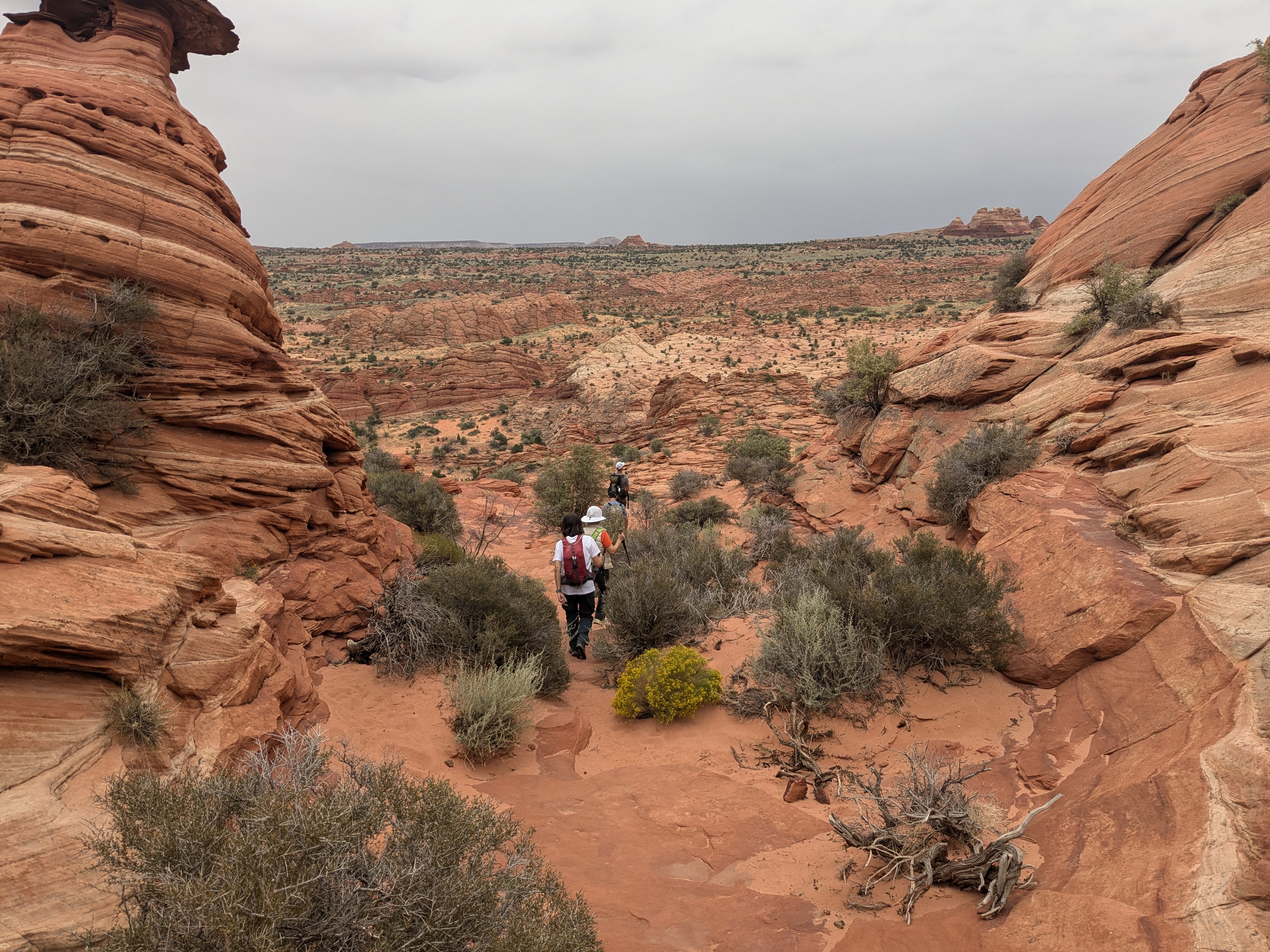
September 21 was the big day. The tour guide Tyler picked us up at 5:15am. We were half awake. It was cold. Tyler is a local. He knows the area really well. He is cautious and prepares his body well with frequent sips of water during the one hour drive there. After all, he must look after us in unexpected circumstances. The first half of the drive is on a smooth freeway. The outside was dark and peaceful. Along the way, there is zero signage to tell Wave’s existence. I think it is intentional to hide it from the public. Without the experience of Tyler, It would be so easy to miss the turn to the unpaved side road to the Wave trailhead. The road becomes unpaved and gets tougher after the turn. We did not see another car until we got to the parking lot. It was too dark to see animals. We did not find any visitor center. Instead, there was a logbook, we registered our group in a log book. That log book is likely the communication protocol for the park range to figure out if everyone leaves the Wave, or gets trapped in the Wave. The pink permit was attached to my backpack all the time.
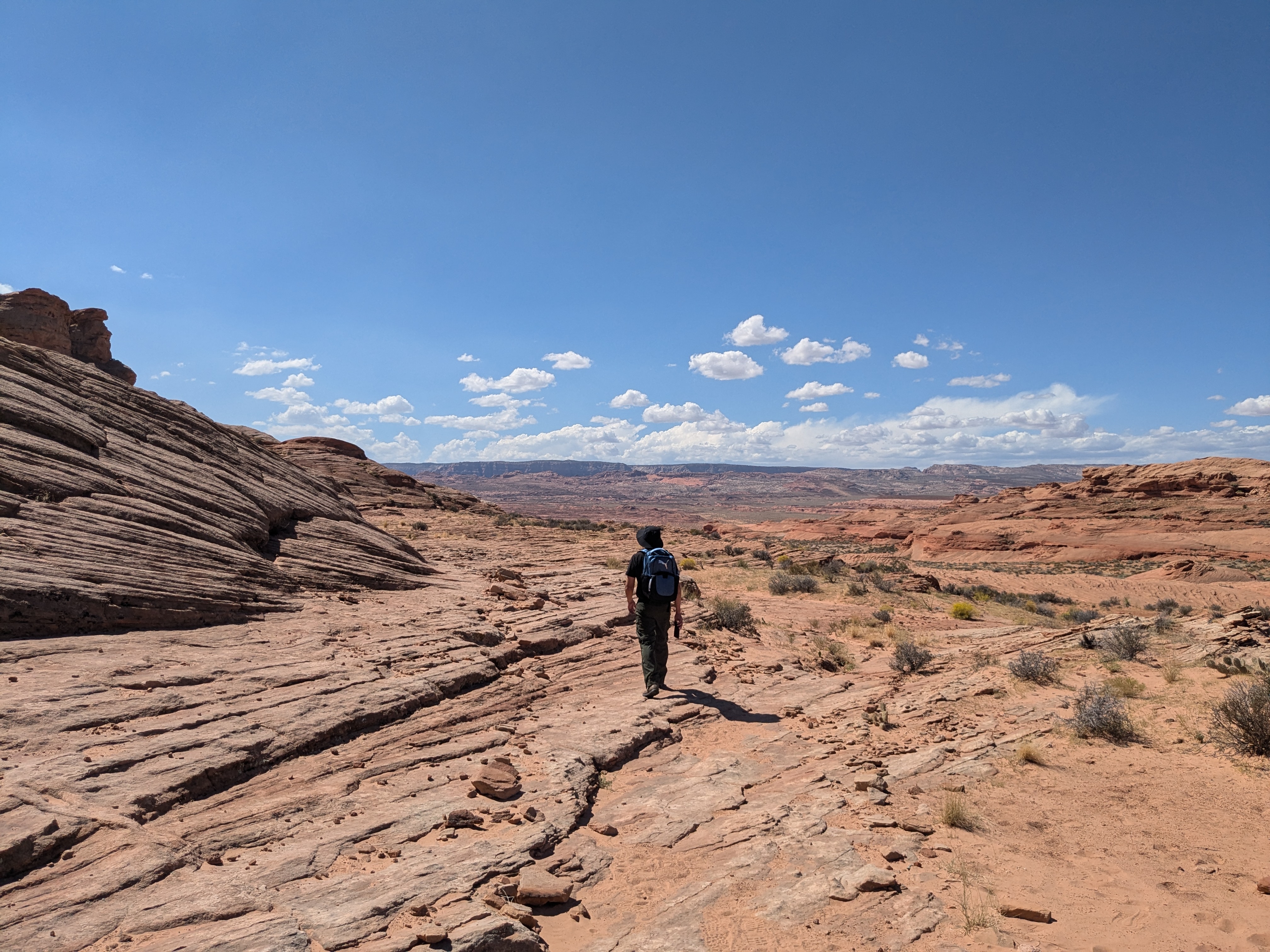
It was overcast, it was cool. There were tiny showers from time to time. It made the perfect weather for a hike. We did not need to consume much energy to overcome the sun. For the first few hours, we had the wilderness for ourselves. We did not run into another group. It was quiet and peaceful. The tour guide helped us with the better routes and avoided slippery terrains.
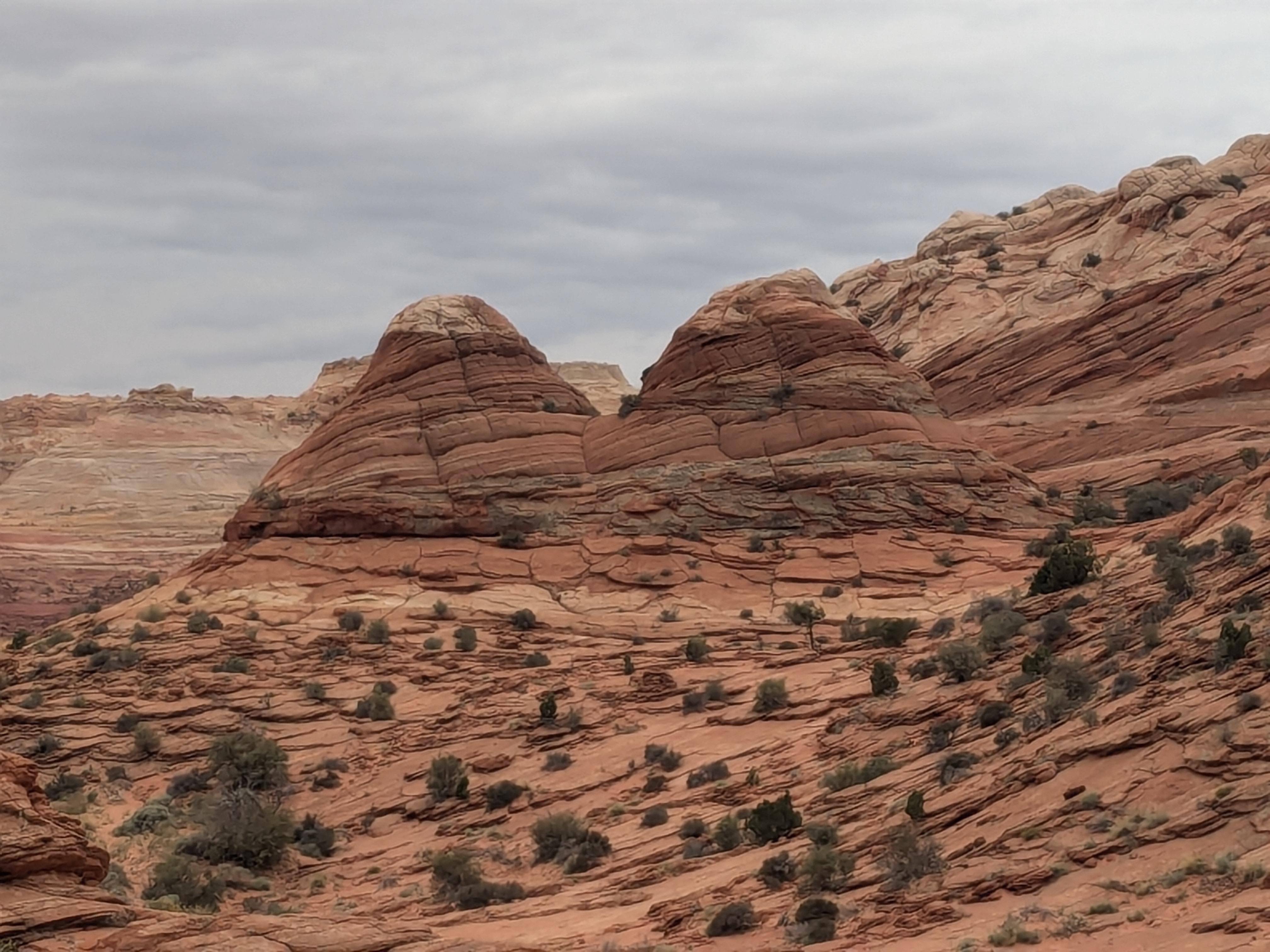
Along the path, there was this big rock that was shaped like a hamburger. Some rocks that looked like cauliflowers, and some just looked like human brains. Because of the shower, we found a few tiny water bodies, with some tadpole shrimps. These tadpole shrimp species have existed for hundreds of millions of years and are likely to exist after we are long gone.
The blue sky was missing that morning. The cooler weather was a blessing. We were also rewarded with different colorings of the terrain. The red rocks, the subtle green and blue color of the terrain came out indescribably beautiful under the cloudy sky.
The Wave is under the “black line”
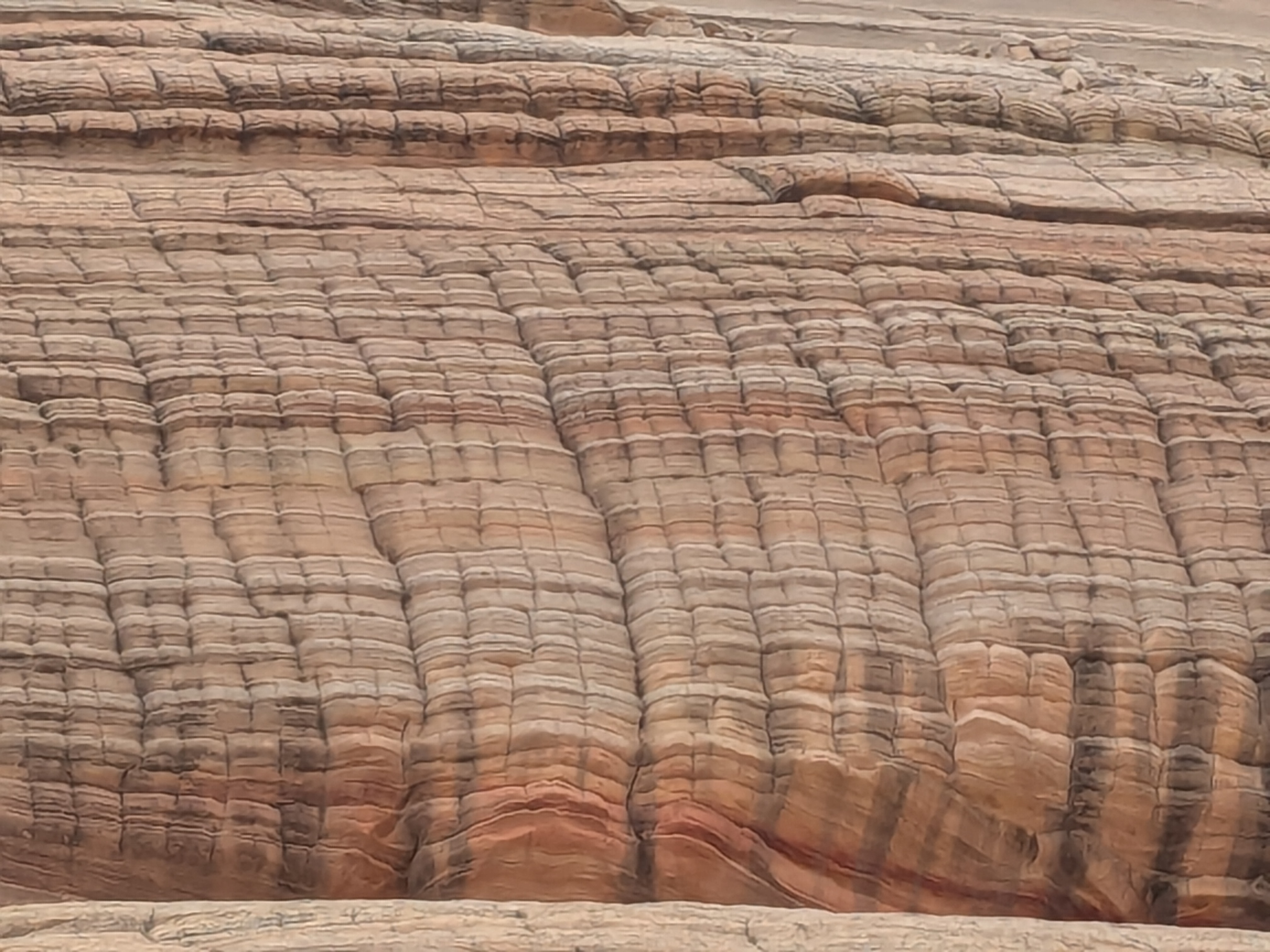
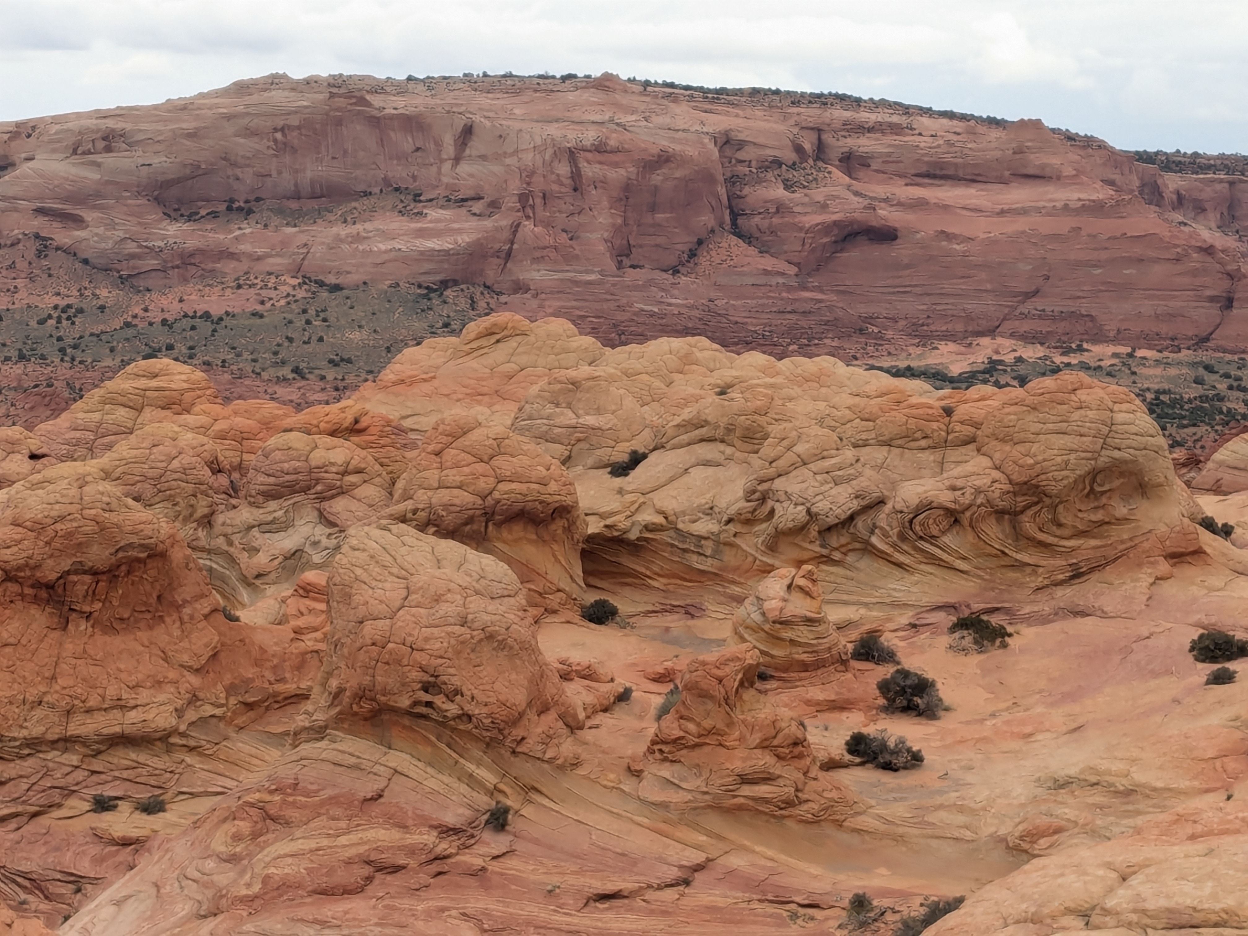
We arrived at the Wave entrance in about three hours. It felt surreal to finally be in the Wave after all these years of lottery, all these weeks of preparation. The photo may disguise the Wave as soft, curly and smooth. In reality, it is formed of incredibly hard sandstones. We enjoyed just staying there to appreciate and had a lunch break. After lunch, Tyler, our tour guide, took us to different “vista” points and an area with the dinosaur footprints.
The sun started to show after lunch. As much as we wanted to enjoy it for more hours, it was time to hike back. We saw a few small groups without a tour guide. They were all busy navigating and we wondered how many backtracking they would experience.
As confident as we felt about the direction and the distinct landmarks on our return trip, we soon realized that we could easily mix up the Teepees and Twin Buttes landmarks with many other look-alikes in the wilderness. The size of the landmark changes too with the distance we are from it. The landscape changes too. The look and feel of the landscape changes too with the weather.
We hiked for almost seven hours for the round trip hike to the Wave. We signed out on the trail-head register before leaving, so concluded the Wave Hike.
The Wave hike is up there as the top three hikes of my life, if not the top. I am going to cherish the beauty and the once-in-a-lifetime hike for the remaining years. I am missing it already.